Wied iż-Żurrieq · Malta
Um El Faroud
A 110 metre Libyan tanker sitting upright on sand at 36 metres, reachable on a shore dive, and broken clean in two by a winter storm. If Malta has one signature wreck for recreational divers, this is it.
Sea conditions
Good right now
Some chop (0.5 m ESE)
Forecast for the site, updated 01:45 AM
- Waves
- 0.5 m
- from ESE
- Wind
- n/a
- Swell
- 0.5 m
- 5 s period
- Sea temp
- 29 °C
Next 7 days
Exposed to wind and swell from: SW (225°), S (180°), SE (135°), W (270°), NW (315°). The wreck sits in the open, so anything from the southern half of the compass puts swell straight over it and makes the surface swim unpleasant. A strong northwesterly wraps round the island and rolls down this coast too, which is why the Blue Grotto boats stop running in a majjistral. In borderline conditions the slipway is the exit that still works. Best season: May to October for the calmest water and the warmest surface swim. Winter visibility is often superb between storms, but the exits are the limiting factor rather than the diving..
The dive
You swim out of the valley, cross a stretch of seagrass and sand, pass a brass diving helmet the size of a washing machine sitting on a concrete block, and then a wall of steel resolves out of the blue. The Um El Faroud is enormous. At 110 metres long and 15 and a half across she does not fit into one dive, or three, and the first time you meet her the scale is the thing that stays with you.
She sits upright and level on sand, stern towards the valley, starboard side turned towards West Reef. Depths run from around 15 to 18 metres at the top of the funnel and superstructure, through 25 on the main deck, to 36 at the keel and the propeller. Before she was sunk the doors and windows were stripped out and cut-through holes were added, so there is a genuine network of routes through the accommodation, the cargo spaces and down the funnel shaft into the engine room. All of it is proper overhead diving and deserves the training that goes with it.
The headline change came in the winter of 2005 into 2006, when a storm finished what the explosion started and snapped her along the old crack line. The two halves have since shuffled apart. The stern is heavier and has settled deeper, the bow has tilted forward, and they have twisted far enough that the port side of one roughly lines up with the starboard side of the other. The gap between them is a few metres wide and, oddly, one of the best bits of the dive: the cross-section of a ship, sliced open and lit from above.
Marine life has thoroughly moved in. Barracuda hang above the deck, groupers own the shadowed corners, and the railings are fuzzy with sponge and hydroid growth.
- Malta's signature wreck: 110 metres of tanker, upright and intact enough to read
- Broken in two, with a walk-through cross-section between the halves
- Reachable from shore, no boat required
- Prepared for diving before scuttling, so the penetration routes are real ones
- Brass diving helmet statue on the sand as a navigational landmark
Typical plan
Giant stride or ladder from the quay, surface swim out of the valley to the West Reef corner, then descend and follow the sand south-west, picking up the helmet statue around 28 metres as your waypoint. Meet the stern first, drop briefly to the propeller at 36, then work forward along the main deck at 24 to 28, look into the break, and finish over the bow section. Turn back over the top of the wreck and ascend via the funnel at 15 to 18 metres, then retrace the sand to the reef and use the 9 metre shelf for your safety stop. Roughly 35 to 45 minutes with nitrox 28 to 32, which buys you real bottom time here; on air you will be watching your computer more than the wreck. Twinset or sidemount and a reel for anything inside the hull.
What the bottom looks like
- 1Posidonia meadow on the swim out22 m deep · 200 m out
- 2Brass diving helmet statue on sand28 m deep · 290 m out
- 3Propeller and rudder on the sand36 m deep · 345 m out
- 4Funnel top, shallowest part of the wreck16 m deep · 370 m out
- 5Stern accommodation block and main deck25 m deep · 395 m out
- 6The break, where the storm split her in two33 m deep · 430 m out
- 7Bow section, tilted forward23 m deep · 490 m out
- 8Open sand beyond the bow35 m deep · 560 m out
Sand and seagrass on the approach, then clean sand around the hull with the wreck standing upright on her keel.
Who you might meet
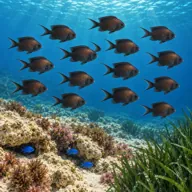
Mediterranean damselfish
Almost always · Kaħlija
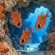
Cardinalfish
Almost always · Re tat-trilji
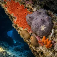
Encrusting sponges
Almost always · Sponża
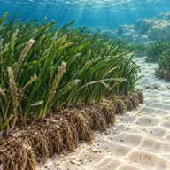
Posidonia meadow
Almost always · Alka
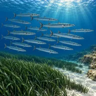
Barracuda
Often · Lizz · summer and autumn

Dusky grouper
Often · Ċerna

Mediterranean moray
Often · Morina

Scorpionfish
Often · Skorfna
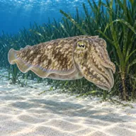
Common cuttlefish
Sometimes · Siċċa · autumn and winter
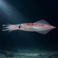
European squid
Sometimes · Klamar · autumn
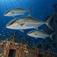
Amberjack
Sometimes · Aċċola · late summer
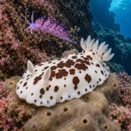
Nudibranchs
Sometimes · spring
Getting in and staying safe
Shore dive from Wied iż-Żurrieq quay, which is the easiest hard part of the day. Park at the bottom of the hill near the steps, at the top of the ramp, or in one of the two official car parks 150 to 200 metres back; in July and August, arrive early or accept a walk. The quay is fully concreted with four ladders and a slipway, and you can giant stride in from almost anywhere along it. The slipway is the most sheltered exit and sometimes the only usable one. Check the ladders are actually in place before you kit up, they get removed or torn off over winter. From the water it is roughly 300 metres of swimming to the wreck, usually done on the surface to the reef corner then down, or on the bottom following the sand with the helmet statue as a waypoint. Restaurants, cafes, shops and public toilets are on the quay, open long hours in summer and much shorter in winter.
- Penetration is a true overhead environment and needs wreck training, lines and torches
- Maximum depth 36 m at the keel, with decompression obligation arriving fast on air
- Loose and sharp corroded metal, especially around the break
- Silt inside the hull, one bad fin kick ends visibility
- Long swim back on the surface if you misjudge gas
- Busy tourist boat traffic between the quay and the Blue Grotto
- Currents can run even on flat days
- Concrete quay and slipway get slippery with algae
- Anglers on the quay, enter well away from their lines
- Lost fishing line snagged on the wreck
A bit of history
She was launched as MV Seafalcon on 31 May 1969 at Smith's Dock Company in Middlesbrough, and spent four years working out of Norway before being sold to Libya in 1973 and renamed Um El Faroud. Owned first by the National Oil Corporation and later by the General National Maritime Transport Company, she carried refined fuel between Italy and Libya until 1995. On the night of 3 February 1995 she was in No. 3 dry dock in Grand Harbour for maintenance when gas in a centre tank exploded. Nine shipyard workers were killed, seven at once and two later in hospital, and others were badly injured; it remains one of the worst peacetime disasters in Maltese history. The blast tore through her midsection and she was surveyed as damaged beyond repair. After three years alongside, the decision was taken to sink her as an artificial reef and diving attraction. She was patched, towed out of Grand Harbour on the morning of Wednesday 2 September 1998 and went down off Wied iż-Żurrieq that afternoon. A memorial to the nine men stands ashore, and the wreck is treated as a memorial too. Seven or eight winters later, a storm broke her in two along the line of the explosion.
Divers say
Sign in to rate this site and leave a note for the next diver.
- No reviews yet. First one gets bragging rights.
Further reading: Wikipedia: Um El Faroud · Dive Systems Malta: Um El Faroud wreck · Wrecksite: Um El Faroud · Tees Built Ships: Seafalcon / Um El Faroud build record · Malta Tourism Authority, Dive Site Report 8: East Reef, West Reef & Caves and Um el Faroud (PDF)