Valletta · Malta
HMS Maori
The forepart of a Tribal-class destroyer lying half buried in sand at sixteen metres in St Elmo Bay, reachable from a ladder and shallow enough for a newly qualified diver. Malta's most accessible piece of the war.
Sea conditions
Excellent right now
Flat, sheltered and calm
Forecast for the site, updated 02:18 AM
- Waves
- n/a
- Wind
- 3 km/h
- SSW, gusts 6
- Swell
- n/a
- Sea temp
- n/a
- air 25 °C
Next 7 days
Sunrise 06:46, sunset 19:04
Exposed to wind and swell from: N (0°), NE (45°), E (90°). St Elmo Bay faces north and north east, and that is the weather that shuts it. In southerly or westerly winds it is flat and comfortable, making Maori a dependable option when the north west of the island is unworkable. Visibility swings from five metres to fifteen or more depending on wind, rain and harbour traffic. Best season: All year, best in spring and autumn when the water is clear and the bay is quiet; good for night diving.
The dive
Maori is the wreck that first time wreck divers in Malta actually get to dive. She sits almost upright with a slight list to port, front end resting against the rocky slope of the bay, about forty two metres of her left in one piece above the sand. Depth runs from nine metres on the upper structure to thirteen on the port side and sixteen to starboard, so the whole thing fits inside open water limits with room to spare.
What survives is unmistakably warship. The main deck and part of the superstructure are still there, along with two big round hatches that were the mounting bases for the forward guns, both weapons having been lifted soon after she sank and put to work as shore batteries. Look for anchor chain, twin bollards at deck level on each side, the remains of the windlass, cables and shells, and a splash guard still in place. Behind the main structure the sand holds more wreckage worth a slow pass, and the bay generally has tyres, barrels and an old motorbike with things living in them.
One important change: do not plan on penetration. Storms in early 2019 did serious damage and the structure has kept collapsing since, so the wreck is now widely considered unsafe to enter. The upside is that fallen side panels have opened her up, and you can see into the hull without ever going inside. Light pours through the holes and portholes, which is exactly what makes this such a good photography wreck.
- A genuine Second World War destroyer, not a scuttled tug, at sixteen metres
- Shore entry from a ladder, no boat and no deco
- Gun mounting rings, bollards, anchor chain and a splash guard still readable
- Fallen side panels that let you look inside without entering
- One of the best night dives in Malta, and a favourite with freedivers too
Typical plan
Drop at the ladder, follow the sand out on a compass heading and the wreck appears at around twelve metres. Circle the hull first at sixteen metres on the starboard side to get the shape of her, then come up onto the deck at nine to twelve and work slowly forward over the gun mounting rings and the bollards. Spend the last fifteen minutes on the debris field behind the wreck and among the tyres and barrels in the bay, which is where most of the small life is. Fifty to sixty minutes on a single 12 litre is normal; air is fine, nitrox 32 just stretches it. Torch for looking into the openings, DSMB before surfacing, and no penetration.
What the bottom looks like
- 1Rocky slope the bow rests against8 m deep · 35 m out
- 2Upper structure and bridge remains, shallowest point9 m deep · 65 m out
- 3Round hatches, the forward gun mounting bases12 m deep · 72 m out
- 4Port side deck, bollards and anchor chain13 m deep · 78 m out
- 5Starboard side on sand, deepest part of the hull16 m deep · 88 m out
- 6Loose wreckage strewn behind the main structure16 m deep · 110 m out
- 7Bay debris, tyres, barrels and an old motorbike15 m deep · 140 m out
Flat sand around the hull with a rocky slope rising against the bow end, and scattered metal wreckage worked into the sand behind.
Who you might meet
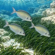
Salema
Almost always · Xilep

Cardinalfish
Almost always · Sultan iċ-ċawl
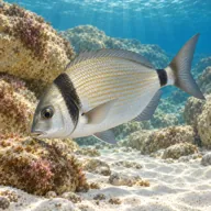
Two-banded seabream
Almost always · Sargu

Hermit crabs
Almost always
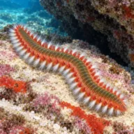
Fireworm
Almost always · Busuf

Octopus
Often · Qarnit

Scorpionfish
Often · Skorfna

Moray eel
Often · Morina
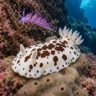
Nudibranchs
Often · Spring
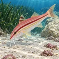
Red mullet
Often · Trilja
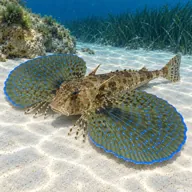
Flying gurnard
Sometimes · Bies · Summer

Stingray
Sometimes · Boll · Summer
Getting in and staying safe
Shore dive with some of the easiest access in Malta. Park at the car park below Fort St Elmo, walk to the St Elmo Bay ladder, and the wreck is a short swim out into the bay. The area also has a cafe with destroyer murals painted on it, bars and toilets when open. Do not leave valuables in the car, this particular car park is notorious for break-ins during dives. The same bay serves the Fort St Elmo reef, so you can plan two very different dives around one parking space.
- Boat traffic in and out of Marsamxett Harbour, carry and use a DSMB
- Collapsing structure, penetration is considered unsafe since the 2019 storms
- Sharp, jagged corroded metal throughout the wreck
- Silt inside and around the hull that kills visibility in seconds
- Swell and surge in the bay in northerly and easterly weather
- Slippery ladder and rock at entry and exit
- Variable visibility from harbour water and boat wash
- Snagged fishing line around the wreckage
- Car break-ins in the dive car park
A bit of history
HMS Maori was a Tribal-class destroyer of the Royal Navy, launched in 1937 and 115 metres long. In May 1941 she took part in the final action against the German battleship Bismarck, firing torpedoes during the night attack of 26 to 27 May and scoring at least one hit. On 12 February 1942 she was moored at the entrance to Dockyard Creek in Grand Harbour when a parachute flare from an enemy aircraft caught in her foremast, lighting her up; she was then hit directly in the engine room and sank. The wreck was raised in July 1945 and the forepart was scuttled in St Elmo Bay, on the Marsamxett side of Valletta, where she has been a dive site ever since. A blue car blown into the sea beside her in a storm in late October 2016 became a minor landmark until it was removed in June 2019.
Divers say
Sign in to rate this site and leave a note for the next diver.
- No reviews yet. First one gets bragging rights.
Further reading: Malta Dive Sites: HMS Maori · Wikipedia: HMS Maori (F24) · Underwater Malta: HMS Maori · NDS Malta: HMS Maori wreck dive · Divewise: HMS Maori WW2 wreck · Malta Tourism Authority dive site report 1: HMS Maori (PDF)