Malta
HMS Jersey
What is left of a J class destroyer that hit a mine at the Grand Harbour entrance in May 1941 and blocked the port for days. Decades of demolition and salvage mean there is scattered wreckage at 19 m rather than a ship.
Sea conditions
Good right now
Some chop (0.5 m E)
Forecast for the site, updated 01:45 AM
- Waves
- 0.5 m
- from E
- Wind
- n/a
- Swell
- 0.5 m
- 5 s period
- Sea temp
- 29 °C
Next 7 days
Exposed to wind and swell from: NE (45°), E (90°), N (0°). The harbour mouth faces north east, so a north easterly makes the whole area unworkable and puts surge along the breakwater. Southerlies and westerlies give the calm days. In practice harbour traffic, not the forecast, decides whether this dive happens at all. Best season: Late spring and autumn, when settled weather and a quiet harbour are most likely to coincide.
The dive
Jersey matters for what she did rather than for what there is to see. A brand new J class destroyer of a hundred and nine metres, she struck an Italian air dropped mine as she came back into Grand Harbour in May 1941, sank right in the entrance and effectively corked Malta's most important port at the worst possible moment. Thirty five of her crew were killed. She broke in two a few days later and the harbour authorities spent years dealing with her.
The aft section was cleared by controlled demolition in the years after the war, and further salvage in the late 1960s removed more of what was left so that big ships could use the channel safely. What survives between the breakwater arms is scattered plating, frames and lumps of machinery lying on the bottom at up to nineteen metres, colonised and softened but nowhere near recognisable as a destroyer.
She is also a war grave. Diving here happens rarely, under Heritage Malta protocols, in a working harbour entrance, and the honest assessment is that unless you have a specific historical interest you will get far more out of an hour on HMS Maori or the X127 lighter. Worth knowing about, worth respecting, not worth building a trip around.
- The destroyer whose loss blocked Grand Harbour during the siege of Malta
- Shallow, at 19 m, but reduced to scattered wreckage by postwar clearance
- A designated war grave with thirty five men lost
- Sits within sight of the HMS Andromeda wreck at the same entrance
- Historically important, visually thin: manage your expectations
Typical plan
If access is arranged, a single tank on air or nitrox, thirty to forty minutes between 12 and 19 m following the debris field along the bottom between the breakwater arms and back to the shot. Keep a marker ready, keep the team together, keep off the silt, and treat every piece of metal as part of a grave. Most divers will find more to look at on HMS Maori or the X127 lighter nearby.
What the bottom looks like
- 1Rock armour at the base of the breakwater11 m deep · 20 m out
- 2Scattered plating and frames17 m deep · 60 m out
- 3Heavier machinery remnants19 m deep · 100 m out
- 4Silty harbour floor19 m deep · 150 m out
Silty sand and rock rubble between the breakwater arms, strewn with demolition debris.
Who you might meet

Cardinalfish
Almost always · Re tat-trilja

Two banded bream
Almost always · Sargu
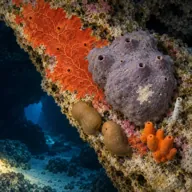
Encrusting sponges
Almost always · Sponża
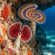
Tube worms
Almost always

Common octopus
Often · Qarnit

Red scorpionfish
Often · Cippullazza
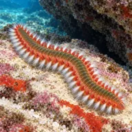
Bearded fireworm
Often · Dudu tan-nar · Summer

Mediterranean moray
Sometimes · Morina
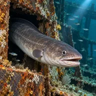
Conger eel
Sometimes · Gringu
Getting in and staying safe
Boat only, inside the breakwater arms at the harbour entrance, which means port clearance and a closed or quiet harbour. Access is through dive centres approved for Malta's protected wreck sites, and the usual war grave conditions apply: nothing is to be touched, moved or recovered. There is no shore entry and no realistic way to swim to the remains.
- Working harbour entrance with commercial and naval traffic
- Requires port clearance and a registered operator
- Designated war grave, no touching or removal of anything
- Surge and reflected swell against the breakwater arms
- Sharp, twisted and unstable wreckage from demolition work
- Silty, variable visibility
- Snagged fishing line along the breakwater base
A bit of history
HMS Jersey, pennant F72, was a J class destroyer built by J. Samuel White at Cowes, launched on 26 September 1938 and commissioned on 28 April 1939. She was about 109 m long with an 11 m beam. On 2 May 1941, returning to Malta, she struck an Italian aircraft laid mine at the entrance to Grand Harbour and sank beside the breakwater with the loss of thirty five men. Her hull blocked the harbour entrance for several days at a critical point in the siege, and she broke into two sections on 5 May. The after section was removed by a series of controlled demolitions carried out between 1946 and 1949, with further clearance work in 1968 to make the channel safe for larger vessels. The site is a designated war grave managed under Heritage Malta protocols.
Divers say
Sign in to rate this site and leave a note for the next diver.
- No reviews yet. First one gets bragging rights.
Further reading: Wikipedia, HMS Jersey (F72) · uboat.net, HMS Jersey (F 72) · Dive Shack Malta, Valletta dive sites · Wrecksite, HMS Jersey