Cominotto · Comino
Cominotto
The uninhabited islet on the far side of the Blue Lagoon, ringed by five or six separate dives that between them cover everything from three-metre sand to a fifty-metre wall.
Sea conditions
Excellent right now
Flat, sheltered and calm
Forecast for the site, updated 01:45 AM
- Waves
- 0.3 m
- from SE
- Wind
- n/a
- Swell
- 0.2 m
- 5 s period
- Sea temp
- 29 °C
Next 7 days
Exposed to wind and swell from: N (0°), NW (315°), W (270°), SW (225°), S (180°). The lagoon side is usable in almost anything short of a northerly gale. The outer western and southern edges need light winds: a westerly or south-westerly makes the points unworkable and a northerly rolls into the channel. Pick the flank that is in the lee and the islet will nearly always give you a dive. Best season: May to October, with July to September giving the warmest water and the longest settled spells.
Dives at Cominotto
Inner Cominotto
Cominotto, Comino
Alex's Cave
Cominotto, Comino
Anchor Reef
Cominotto, Comino
Cominotto Rock
Cominotto, Comino
Blue Lagoon
Cominotto, Comino
The dive
Cominotto, Kemmunett to Maltese ears, is the lump of rock that makes the Blue Lagoon a lagoon. Nobody lives on it, nothing is built on it, and the whole perimeter is dive-able. That is why it appears here as an area rather than a single site: the sheltered eastern flank facing Comino is shallow and benign, while the outer western and southern edges fall away into proper blue water.
Work clockwise and the character changes completely. The inner southern shore is a nine-metre algae-topped shelf with pockets of small cave. The north-western outer edge stacks up into boulder walls with old anchors jammed in the gaps. The south-western point drops vertically past forty metres onto white sand. Nobody dives all of it in one go, and the guides who know the islet will pick a spot based on where the wind is coming from that morning, which is the real advantage of a site with 360 degrees of coastline.
Water clarity here is some of the best in the Maltese islands, routinely twenty-five to thirty-five metres in the calm months, partly because there is no river, no runoff and very little sediment to stir. The flip side is that there is almost no shelter: once you leave the lagoon side, you are in the channel and the surface can be lumpy even on a nice day.
Treat this entry as the doorway. Pick the specific dive (Inner Cominotto, Cominotto Rock, Anchor Reef, Alex's Cave) and read the conditions notes for that one, because they differ a lot.
- A whole islet of coastline, so there is nearly always a lee side to dive
- Twenty-five to thirty-five metres of visibility on a good day
- Old anchors wedged in the boulders on the outer reefs
- Shallow cavern dives and a fifty-metre wall within a few hundred metres of each other
Typical plan
Most operators run two dives here on one trip: something deep on the outer flank first (Cominotto Rock or Anchor Reef, thirty to forty metres, twenty-five minutes of bottom time, nitrox 28 or 32 if you have it), then a long shallow second dive on the inner shore or in the lagoon at ten to fifteen metres for an hour. Surface interval is spent moored in the Blue Lagoon, which is not a hardship.
What the bottom looks like
- 1Shallow algae and Posidonia shelf6 m deep · 25 m out
- 2Small caves and overhangs at the rock base12 m deep · 90 m out
- 3Stacked boulder field with swim-throughs20 m deep · 150 m out
- 4Outer drop-off28 m deep · 190 m out
- 5Vertical wall on the outer flank38 m deep · 240 m out
- 6White sand at the wall base50 m deep · 310 m out
Upper coralline limestone reef and boulder debris on the flanks, running out to clean white sand and scattered Posidonia beyond the drop-offs.
Who you might meet
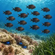
Damselfish
Almost always · Kaħlija
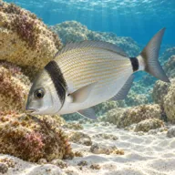
Two-banded seabream
Almost always · Ħaddiema
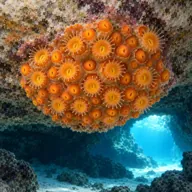
Golden cup coral
Almost always · Qroll tad-dell
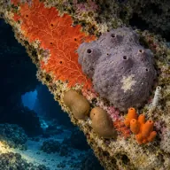
Encrusting sponges
Almost always · Sponża
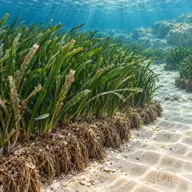
Posidonia meadow
Almost always · Ħaxix il-baħar

Dusky grouper
Often · Ċerna

Mediterranean moray
Often · Morina

Common octopus
Often · Qarnita
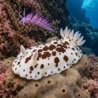
Nudibranchs
Often · Spring

Barracuda
Sometimes · Lizz · Summer and early autumn

Greater amberjack
Sometimes · Aċċola · Late summer
Getting in and staying safe
Boat only. Most groups run from Ċirkewwa (about fifteen minutes), from Marfa, or from Sliema and Buġibba on a full day trip of roughly forty-five minutes each way. Boats moor in the Blue Lagoon or lie off the point depending on which dive is planned. There is nothing on the islet itself: no landing, no shade, no facilities. Everything you need comes on the boat with you.
- Boat traffic, heavy in summer, including fast ferries in the channel
- Exposed outer edges with current on the points
- Depth: the outer sites run past recreational limits without much warning
- Surge against the rock in any swell
- Lost fishing line and net snagged on the anchors and boulders
- No shore exit anywhere, so surface positioning and an SMB matter
- Jellyfish blooms in August and September
A bit of history
Cominotto and Comino were quarried and grazed rather than settled, and the channel between them has been a small-boat anchorage for centuries, which is why so many lost anchors are still wedged in the reefs off the islet. The rock is upper coralline limestone, hard and well jointed, which is what produces the vertical faces and the stacked boulder architecture rather than the smooth slopes you get on softer globigerina coasts.
Divers say
Sign in to rate this site and leave a note for the next diver.
- No reviews yet. First one gets bragging rights.
Further reading: Calypso SAC, Cominotto Rock · Calypso SAC, Inner Cominotto · Seashell Dive Centre, Outer Cominotto Reef · Paradise Diving, Comino dive sites