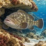
A stepped west coast wall just south of Ras ir-Raheb that drops in stages to 50 m, with a small cave at the surface, a boulder field to the north and grouper wedged under every big rock.
 Wall
Sea conditions
Stay dry right now
Sea is up (4.4 m WNW) · Fresh W wind (32 km/h) · Gusts to 49 km/h
Done for today. Tomorrow: not looking good. Best it gets is 22 at 17:00: Sea is up (1.7 m WNW)
Forecast for the site, updated 19:45 · Models disagree
Measured at Qammieħ (8.3 km away, 20:29): 24 km/h from W, gusts 40. The next hours lean on it.
- Waves
- 4.4 m
- from WNW, biggest 7.3
- Wind
- 32 km/h
- W, gusts 49
- Swell
- 0.4 m
- 11 s period
- Sea temp
- 22 °C
- air 18 °C
Hour by hour
Next 7 days
 0 4.5 m
51 W
 0 4.3 m
49 WNW
40 1.1 m16 WNW
92 0.3 m13 ESE
91 0.3 m11 E
 86 0.3 m
18 NNW
88 0.3 m16 SSW
Sunrise 06:25, sunset 17:06
Waves: Copernicus Med-Waves 4 km + MFWAM 8 km + EWAM 5 km + ECMWF WAM 9 km. Wind: ICON-2I 2 km + ECMWF IFS 9 km + ICON-EU 7 km + UKMO 10 km + ARPEGE 11 km. Read a few km out on the side the site is open to, then blended.
Exposed to wind and swell from: W (270°), NW (315°), SW (225°). Sheltered from the north-east, which is the local land wind, and fully open to anything from the west. In practice that means it is a summer site that goes from glass to unworkable with one change of forecast. Best season: June to October, best in the settled easterly spells of late summer.
The dive
This is the piece of coast immediately below the Ras ir-Raheb headland, and it dives quite differently from the headland itself. Instead of one vertical face, the ground falls away in a series of narrow terraces, each one a few metres lower than the last, until you are standing on flat rock and sand somewhere around 50 m. That staircase makes it far easier to control than a sheer drop, which is why it suits an advanced diver rather than a deep specialist.
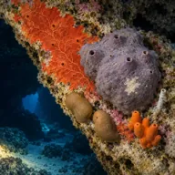
The wall itself is well grown in. Sponges, algae and encrusting life have taken over the vertical bits, and clouds of damselfish and small silver fish hang off the face wherever there is a current line. Head north along the section and the terraces break up into boulders, and that is where the grouper live, tucked under the overhangs with just a lip and an eye showing.
There is a small cave right at the waterline. It is shallow and open, more of an alcove than a system, so it makes a nice ten-minute finish rather than a project. If your skipper drops you a little further north on the neighbouring Blata tal-Melh ground you get much the same profile plus a broad valley that works beautifully as a place to hang out your stops.
- A wall that steps down rather than falls, so the depth stays manageable
- Grouper under almost every boulder on the northern section
- Small surface cave that makes an easy landmark and a nice finish
- Colourful sponge growth on the vertical sections
Typical plan
In at the cave, straight down the terraces to a planned 30 to 35 m, then north along the boulder ground looking under the overhangs for about fifteen minutes. Turn, come up one terrace at a time so the ascent is built into the route, and spend the last part of the dive between 12 and 6 m on the wall growth. Air works fine if you stay at 30 m, but nitrox 30 makes the whole thing more relaxed. Carry a DSMB and a torch.
What the bottom looks like
- 1Small open cave at the waterline2 m deep · under the boat
- 2First terraced step18 m deep · 17 m from the boat
- 3Narrow ledges dropping in stages30 m deep · 37 m from the boat
- 4Boulder ground to the north with grouper holes36 m deep · 52 m from the boat
- 5Sand and flat rock at the base52 m deep · 97 m from the boat


Stepped limestone ledges and tumbled boulders over a floor of sand mixed with flat bedrock at around 50 m.
Who you might meet
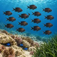
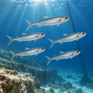
Sometimes

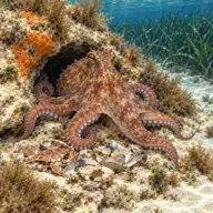
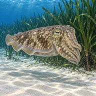
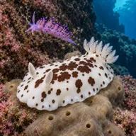
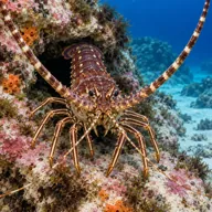
Marked ones can hurt you. What they do and what to do about it is under Getting in and staying safe.
Getting in and staying safe
Boat only. Boats come from Cirkewwa or Gnejna, or across from the south when the west is unusually flat. The skipper will typically put you in at the small surface cave so you have a landmark to work back to, then follow the coast. There is nothing on shore here beyond cliff and scree, so plan for a full live-aboard-the-RIB day with your surface interval spent afloat.
- Depth: the terraces make it easy to keep stepping down past 40 m
- Exposed west coast swell and surge against the wall
- Current along the wall, stronger the closer you get to the Ras ir-Raheb point
- No shore exit and no phone signal worth relying on
- Discarded fishing line caught on the boulder edges
Marine life to respect
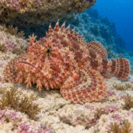
Red scorpionfish · Ċippullazza Can hurt you
Venomous spines, and it sits still on the rock. Look before you kneel or hold on; hot water if stung.
Divers say
Sign in to rate this site and leave a note for the next diver.
- No reviews yet. First one gets bragging rights.
Further reading: Calypso Sub-Aqua Club: Rdum tal-Vigarju · Calypso Sub-Aqua Club: Blata tal-Melh · Malta Dive Sites west coast index