Reef off Marija's Cave
An offshore reef edge west of the Gnejna cliffs that steps down in roughly fifteen metre drops from about 20 m to past 60 m. Barely dived, properly deep, and full of holes worth a torch.
 Reef
 Wall
Divers rarely, if ever, come here.
We found no record of anyone diving this site. It is charted so the picture of what lies under the water is complete, not because it is a place to go: there is no set route, no local briefing to lean on, and nothing on this page has been proven in the water.
Sea conditions
Stay dry right now
Sea is up (4.3 m WNW) · Fresh W wind (32 km/h) · Gusts to 48 km/h
Done for today. Tomorrow: not looking good. Best it gets is 21 at 17:00: Sea is up (1.6 m WNW)
Forecast for the site, updated 19:45 · Models disagree
Measured at Qammieħ (5.7 km away, 20:29): 24 km/h from W, gusts 40. The next hours lean on it.
- Waves
- 4.3 m
- from WNW, biggest 6.7
- Wind
- 32 km/h
- W, gusts 48
- Swell
- 0.4 m
- 8 s period
- Sea temp
- 22 °C
- air 18 °C
Hour by hour
Next 7 days
 0 4.3 m
51 W
 0 4.2 m
49 WNW
43 1.0 m16 WNW
92 0.3 m13 ESE
91 0.3 m11 E
 88 0.3 m
18 NNW
90 0.3 m16 SSW
Sunrise 06:25, sunset 17:06
Waves: Copernicus Med-Waves 4 km + MFWAM 8 km + EWAM 5 km + ECMWF WAM 9 km. Wind: ICON-2I 2 km + ECMWF IFS 9 km + ICON-EU 7 km + UKMO 10 km + ARPEGE 11 km. Read a few km out on the side the site is open to, then blended.
Exposed to wind and swell from: W (270°), NW (315°), SW (225°), N (0°), S (180°). Offshore on the western side, so it takes weather from most of the open sectors and has no cliff to hide behind. It needs a flat, settled day with light wind, and even then the surface can be lumpier than a coastal site in the same forecast. Best season: July to October, when the western sea settles and visibility is at its best.
The dive
This one sits out in open water off the Ta' Marija cave, between Gnejna and Fomm ir-Rih, and it is the sort of site that exists on a chart and in a handful of logbooks rather than in any guidebook. The top of the reef comes up to around 16 to 20 m, and from there the edge falls away in a series of big steps, each one dropping you roughly fifteen metres before the ground levels briefly and then goes again. Keep following it and you are past 60 m with the bottom still not in sight.
The reason to come is the wall face itself. Being offshore and rarely visited, the cracks and undercuts are properly occupied: lobster antennae poking out of holes, grouper that have not learned to be nervous, and whatever else has decided that an unfished ledge at 40 m is a good address. Visibility out here is typically excellent because there is no shore influence at all.
It is honestly a technical or advanced deep dive rather than a recreational one. There is no shallow reserve above you to play with, no shore, and nothing to navigate by except the reef edge. Go with a skipper who knows exactly where the lip is, dive it on a line or a very clear plan, and treat the first step down as your limit unless you are properly equipped.
- A stepped offshore reef that keeps dropping past 60 m
- Undercuts and cracks stuffed with lobster and grouper
- Offshore visibility with no shore influence at all
- A site almost nobody has logged
Typical plan
Descend on a shot to the top of the reef at 16 to 20 m, orient on the lip, then drop down the first step and run the face at 35 to 40 m for ten to twelve minutes, keeping the wall on one shoulder. Come back up onto the reef top and spend the rest of the dive there before a mid-water ascent on a DSMB. Nitrox 28 to 30 for a 40 m plan, or trimix and staged deco if you intend to follow the steps deeper. Because this is a rarely visited offshore mark, dive it conservatively and treat the reef top as your safe reference rather than the bottom.
What the bottom looks like
- 1Top of the reef at about 16 to 20 m17 m deep · under the boat
- 2First step down26 m deep · 20 m from the boat
- 3Undercut face with lobster holes35 m deep · 33 m from the boat
- 4Second major step50 m deep · 58 m from the boat
- 5Deep ground beyond 60 m62 m deep · 93 m from the boat


Hard offshore reef in stepped terraces, with sand and coarse rubble collecting on each ledge and at the base.
Who you might meet

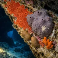
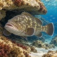
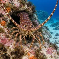
Sometimes
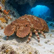

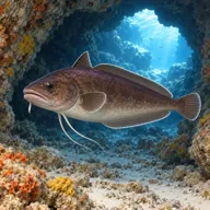
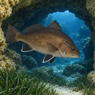
Lucky day
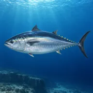
Marked ones can hurt you. What they do and what to do about it is under Getting in and staying safe.
Getting in and staying safe
Only for serious professionals who know exactly what they are doing. With no record of anyone diving here there is no one to ask and no set route, so treat every line below as the start of your own planning, not a briefing. Plan it as an expedition, not a dive.
Boat only, and it needs a skipper who can find an offshore lip with a sounder rather than lining up on landmarks. Runs normally come from Gnejna or up from the south coast. Expect a live-boat pick-up in open water, so DSMBs and a solid surfacing plan matter more than usual. Nothing on shore anywhere nearby.
- Genuinely deep: the reef keeps stepping down past 60 m
- Open water with no shore and no shallow ground to retreat to
- Current running along and over the reef edge
- Easy to lose the reef lip and end up over blue water
- Rarely dived, so no established route or fixed line
- Surface traffic and swell on an exposed offshore mark
Marine life to respect
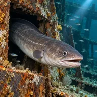
Conger eel · Gringu Can hurt you
Crushing bite if a hand goes into its hole. Look in from a distance and keep fingers out.
Divers say
Sign in to rate this site and leave a note for the next diver.
- No reviews yet. First one gets bragging rights.
Further reading: Calypso Sub-Aqua Club: Reef off Ta' Marija Cave · Malta Dive Sites west coast index