Malta
Levant II
A small cable ship sitting upright and largely whole at fifty nine metres, about a kilometre off the mouth of Grand Harbour. She spent ten years on divers' logs as simply the cable ship before anyone worked out her name.
Sea conditions
Good right now
Some chop (0.5 m E)
Forecast for the site, updated 01:45 AM
- Waves
- 0.5 m
- from E
- Wind
- n/a
- Swell
- 0.5 m
- 5 s period
- Sea temp
- 29 °C
Next 7 days
Exposed to wind and swell from: N (0°), NE (45°), E (90°), SE (135°). The site faces the open north east, so a gregale or any easterly sets up a swell that both makes the run out unpleasant and rules out decompression on a bouncing line. Calm summer mornings with light westerlies, and a quiet harbour schedule, are the combination you want. Best season: May to October. Early mornings before the day's shipping and ferry movements build up are the practical window..
The dive
For a wreck barely forty metres long, Levant II punches well above her weight. She sits on a rocky bottom close to fifty nine metres, essentially intact, with the great cable drum still mounted forward where it always was. Get down onto the deck and the layout reads immediately: drum, winches, superstructure, a modest stern. On one of the brass fittings you can still pick out a maker's name and the date 1911, which is the sort of small, human detail that makes a deep wreck memorable.
She is compact enough that a well organised team can see all of her in a single bottom time, which is unusual for a Maltese deep wreck and part of why she has a following. The structure is small scale and the growth is heavy, so expect cup corals, sponges and a resident cast of cardinalfish, conger and grouper using the openings as apartments.
The complication is where she lies. A kilometre off the breakwater puts her inside the approaches to one of the busiest harbours in the central Mediterranean. Cruise ships, container traffic and the Gozo and Sicily routes all converge here. Teams dive her when harbour movements allow it and with serious surface cover, and if the port is busy the trip does not happen. Treat that constraint as part of the dive, not an inconvenience.
- Cable drum still standing on the foredeck
- Brass fitting dated 1911 with the maker's name legible
- Small enough to see the whole ship in one bottom time
- A wreck that was anonymous for a decade after rediscovery
Typical plan
Mixed gas, tight schedule. Down the shot to the superstructure around fifty two metres, a lap of the deck from drum to stern at fifty three to fifty eight metres for twenty minutes, then back to the line. A normoxic trimix bottom mix with 50 percent and oxygen for stops gives roughly thirty to forty minutes of decompression. Deploy from the line rather than free ascending, and have the boat watching you and the traffic the whole time.
What the bottom looks like
- 1Upper superstructure where the shot lands52 m deep · 18 m out
- 2Cable drum on the forward deck53 m deep · 26 m out
- 3Brass fittings with maker's name and 1911 date54 m deep · 38 m out
- 4Bridge area and deck winches55 m deep · 52 m out
- 5Stern section58 m deep · 76 m out
- 6Rock and sediment bottom alongside the hull59 m deep · 86 m out
Rocky bottom with a thin veneer of sediment, so the wreck sits proud rather than sinking into soft mud.
Who you might meet
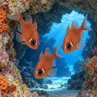
Cardinalfish
Almost always · Sultan iċ-ċawl
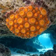
Golden cup coral
Almost always · Qroll tad-dell
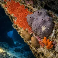
Encrusting sponges
Almost always · Sponża

Dusky grouper
Often · Ċerna
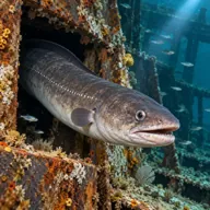
Conger eel
Often · Gringu

Scorpionfish
Often · Ċippullazza

Mediterranean moray
Sometimes · Morina
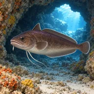
Forkbeard
Sometimes · Lipp tal-qawwi
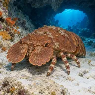
Slipper lobster
Sometimes · Ċikala
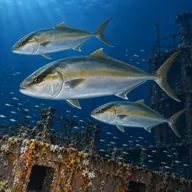
Amberjack
Sometimes · Aċċola · autumn
Getting in and staying safe
Boat only, and a short run: she sits about a mile out from the St Elmo breakwater light. Departures are usually from Sliema, Marsamxett or Kalkara. Diving is coordinated around harbour traffic, so trips can be cancelled or moved at short notice by port movements. Expect a shot line, a good surface marker, a lookout on the boat at all times and a flag that actually gets seen. This is not a site to dive from a small rib without proper cover.
- Commercial shipping in and out of Grand Harbour directly overhead
- Depth of fifty nine metres, requiring mixed gas and full deco planning
- Current running across the harbour approaches
- Free ascents in a shipping lane are genuinely dangerous, stay on the line
- Snagged fishing line and discarded gear on the superstructure
- Reduced visibility from harbour outflow after heavy rain
- Small confined openings if you choose to penetrate
A bit of history
She was launched in 1904 as a trawler and rebuilt as a cable layer for the Eastern Telegraph Company, a vessel of around 283 gross tons and roughly forty two metres long. She served in the Dardanelles during the First World War, and afterwards worked out of Malta laying and maintaining the telegraph cables that tied the island to Sicily, Libya and Alexandria. Her cable career ended around 1935 and she passed through several owners and names. By 1952 she was worn out and condemned for scrap. Under tow towards the spoil ground some three miles off Grand Harbour she began taking water and went down early, closer inshore than intended. Local divers found her again around 1999, and for a decade she was known only as the cable ship. A photograph circulating online eventually gave her back her identity as Levant II.
Divers say
Sign in to rate this site and leave a note for the next diver.
- No reviews yet. First one gets bragging rights.
Further reading: Calypso Sub-Aqua Club, Cable Ship Levant II · Divers Guide, Levant II site information · Techwise Malta, Levant 2 · Wrecksite, Levant II