L'Ahrax Point · Malta
L'Ahrax Point
The northern tip of Malta, and a whole cluster of shallow dives rather than one: a small cavern at the point, a tunnel you can surface in, a collapsed lagoon open to the sky, and a long boulder reef offshore. Beginner friendly water with an awkward entry.
Sea conditions
Excellent right now
Flat, sheltered and calm
Diveable for the rest of the day.
Forecast for the site, updated 12:44 PM · Models disagree
Measured at Mġarr, Gozo (6.9 km away, 01:50 PM): 4 km/h from SSE, gusts 5. The next hours lean on it.
- Waves
- 0.2 m
- from SSW, biggest 0.2
- Wind
- 9 km/h
- NNW, gusts 14
- Swell
- 0.2 m
- 4 s period
- Sea temp
- 29 °C
- air 25 °C
Hour by hour
Next 7 days
Sunrise 06:47, sunset 19:04
Waves: Copernicus Med-Waves 4 km + MFWAM 8 km + EWAM 5 km + ECMWF WAM 9 km. Wind: ICON-2I 2 km + ECMWF IFS 9 km + ICON-EU 7 km + UKMO 10 km + ARPEGE 11 km. Read a few km out on the side the site is open to, then blended.
Exposed to wind and swell from: NW (315°), N (0°), NE (45°), E (90°). The northern tip catches everything from the northwest round to the east. A majjistral blowing makes the entry dangerous and fills the cavern with surge, and a grigal is worse. Southerly and southwesterly winds leave it glassy, which is when it is at its best. Being shallow, it warms up early and stays pleasant well into autumn. Best season: May to October, on southerly wind days.
Dives at L'Ahrax Point
The dive
L'Ahrax is where Malta runs out of island. The headland north of Mellieha is low, scrubby garigue with a tower on it, and the coastline underneath is a playground: shallow rock, boulder fields, small canyons and a set of features that photograph better than most sites twice the depth.
Four things draw divers here. The cavern at the very tip is easy to find by simply following the shoreline. The tunnel runs through the rock and opens to the sky, so snorkellers can enjoy it too. The inland sea, better known above water as the Coral Lagoon, is a cave whose roof fell in, leaving a near circular pool with rock walls rising ten metres overhead and light pouring down into it. And the north reef stretches out with rock, sand and Posidonia, more than you can cover in a dive and far enough out that it makes a better boat dive.
Depths are modest, averaging around seven metres with eighteen typical on the reef and thirty if you push offshore, so it suits training and long, relaxed dives. The catch is the entry: the shore access is over rough rock, and from the water's edge you are looking at a swim of ten minutes or more to the good stuff. Plenty of centres just take the boat and skip the argument.
- Surfacing inside a collapsed cavern with the sky ten metres above you
- A tunnel shallow enough that snorkellers get to enjoy it too
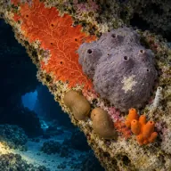
- Cup coral and red sponge colour in the cavern, a photographer's site
- A long reef with canyons and swim throughs that rewards a boat drop
- Shallow enough for beginners and long enough for very relaxed dive times
Typical plan
From a boat, drop near the point, do the cavern and tunnel first at three to six metres, surface briefly inside the lagoon for the theatre of it, then work the reef outwards to twelve or fifteen metres and drift back through the boulders. Fifty to sixty minutes on a single 12 litre of air or nitrox 32 is easy at these depths. From shore, budget the first and last ten minutes of the dive as transit and plan a shallower, shorter route.
What the bottom looks like
- 1Small cavern at the tip of the point4 m deep · 40 m out
- 2Tunnel through the rock, open to the sky6 m deep · 110 m out
- 3Inland sea with collapsed roof, the Coral Lagoon9 m deep · 150 m out
- 4Boulder field with small canyons and swim throughs11 m deep · 260 m out
- 5Posidonia meadow on sand15 m deep · 380 m out
- 6North reef, the long offshore section19 m deep · 500 m out
- 7Outer edge dropping towards thirty metres26 m deep · 650 m out
Rock and tumbled boulders inshore, giving way to sand with Posidonia meadows further out.
Who you might meet
Almost always
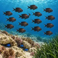
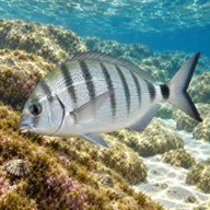
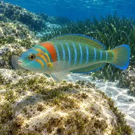
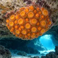
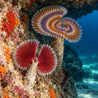
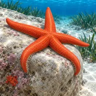
Often

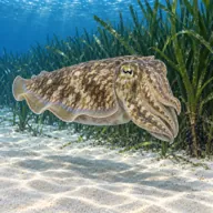
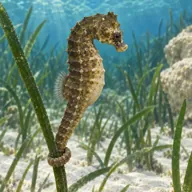
Marked ones can hurt you. What they do and what to do about it is under Getting in and staying safe.
Getting in and staying safe
Two options. By shore, park at the L-Ahrax tal-Mellieha campsite area near the tower and carry kit down to the rocks; the entry is genuinely awkward over uneven rock and there is a swim of at least ten minutes to reach the cave, more to reach the reef. Facilities at the campsite include toilets, showers and somewhere to eat, which is more than most Maltese shore sites offer. By boat it is a short run from Mellieha or Cirkewwa and drops you straight onto the features, which is why most centres prefer it. Weekend and summer traffic on the headland can make parking a nuisance.
- Rough, slippery rock entry and exit
- Long surface swim from the shore entry to the features
- Surge inside the cavern and tunnel when there is any northerly swell
- Boat and jet ski traffic around the point in summer
- Shallow rock close to the surface, easy to get pushed onto
- Exposed headland with no shade and a long carry back to the car
- Jellyfish drifting in on the current in late summer
Marine life to respect

Mediterranean moray · Morina Can hurt you
Bites hard if a hand goes into its hole. Keep hands out of cracks and never feed one.

Red scorpionfish · Ċippullazza Can hurt you
Venomous spines, and it sits still on the rock. Look before you kneel or hold on; hot water if stung.
A bit of history
No wreck here. The story is geology and a little folklore. The lagoon and the tunnel exist because sea caves eroded into the Upper Coralline limestone of the headland and their roofs eventually collapsed, the same mechanism that produced Gozo's Inland Sea and, in its most famous and most mourned form, the Azure Window that fell into the sea at Dwejra in March 2017. The point takes its name from L-Ahrax tal-Mellieha, the rough open ground behind it, and the tower on the headland is one of the coastal watch towers built when Malta's coast was a frontier.
Divers say
Sign in to rate this site and leave a note for the next diver.
- No reviews yet. First one gets bragging rights.
Further reading: Malta Dive Sites: L'Ahrax Point · Malta Dive Sites: Inland Sea, L'Ahrax Point · Seashell Dive Centre: Dragonara Cave, L'Ahrax Point · Divers Guide: Ahrax Point · PADI: L'Ahrax Point dive site