Delimara · Malta
Delimara Wreck
A broken up barge scattered across sand and rock in less than 10 metres of water on the sheltered side of Delimara Point. A bonus dive rather than a main event, and none the worse for it.
Sea conditions
Good right now
Some chop (0.5 m E)
Forecast for the site, updated 01:46 AM
- Waves
- 0.5 m
- from E
- Wind
- n/a
- Swell
- 0.5 m
- 5 s period
- Sea temp
- 29 °C
Next 7 days
Exposed to wind and swell from: SE (135°), S (180°), SW (225°). The most sheltered dive on the peninsula, tucked on the western side where an easterly cannot reach it. A southwesterly puts swell straight in though, and at this depth surge will roll you across the wreckage. Visibility drops faster here than on the reefs because the bottom is sand. Best season: Usable across most of the year when the wind is anywhere in the north or east. High summer gives the best light on the wreckage..
The dive
Nobody would drive all the way out to Delimara just for this, but if you are already there it earns twenty minutes of your day. A working barge of decent size went down here and came apart, and what is left is spread across sand and low rock between 5 and 9 metres.
Plating, framing and lumps of steel sit low in the sand, most of it now furred with algae and encrusting growth. Octopus move into the gaps, small bream shoal around the taller pieces and the shallow depth means you can idle over it for as long as your patience and your surface interval allow. The light down there is excellent, which makes it a far better photographic subject than the word barge suggests.
It is also the most forgiving corner of the peninsula. Tucked round on the western side, it stays usable when a little swell is running from the east and the reefs on the other side of the point are out of the question.
- Shallow enough for an hour and change without touching your no-stop clock
- Broken steel that has turned into good octopus and scorpionfish habitat
- Beautiful light for photography at 6 to 9 metres
- The fallback dive when the rest of Delimara is blown out
Typical plan
An easy second dive. Walk in on the western side, drop to 4 metres and swim out on a bearing until the first plates show up on the sand. Circle the wreckage slowly, then widen out to pick up the scattered pieces before working back along the rock toward the exit. Sixty to seventy five minutes on a single cylinder is realistic at this depth; cold rather than gas will end the dive in spring. Keep a surface marker deployed if any boats are working the area and surface right beside your exit rather than out in open water.
What the bottom looks like
- 1Sand and rubble approach from the rocks5 m deep · 60 m out
- 2Main section of the broken barge8 m deep · 95 m out
- 3Scattered plating and framing on the sand9 m deep · 125 m out
- 4Boulders at the edge of the debris field9 m deep · 160 m out
Fine sand and rubble with scattered low rock, the wreckage sitting proud of it in broken sections.
Who you might meet
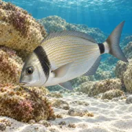
Two-banded bream
Almost always · Sargu

Damselfish
Almost always · Ċawl
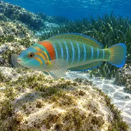
Ornate wrasse
Almost always · Tirda tal-passa
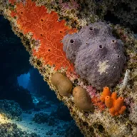
Encrusting sponges
Almost always · Sponża

Octopus
Often · Qarnit

Scorpionfish
Often · Ċippullazza
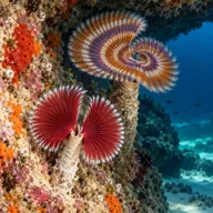
Tube worms
Often

Moray eel
Sometimes · Morina
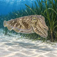
Cuttlefish
Sometimes · Siċċa · Spring
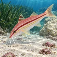
Red mullet
Sometimes · Trilja
Getting in and staying safe
Same rough roadside parking by Delimara Lighthouse, then a walk across the neck of the point to the western side. The ground is uneven but the carry is short and the entry is over low rock into shallow water. Because the wreckage sits in only a few metres, a snorkel over the top first is a quick way to confirm you are in the right place before you kit up. No toilets, no cafe, no shade; Marsaxlokk is ten minutes back up the road.
- Sharp torn steel and protruding framing, gloves and good buoyancy help
- Shallow depth means boat propellers are close, use a surface marker
- Fishing line and lost tackle snagged on the higher pieces
- Rock entry and exit with no ladder
- Surge over the wreck when there is any swell in the bay
- Silt stirs easily off the sand between the plates
A bit of history
Documentation for this hull is thin. It is an unglamorous working barge rather than a warship, with no confirmed name or sinking date in the usual wreck registers, which is why every guide simply calls it the Delimara wreck. If you want documented wreck history on this coast, the deliberately scuttled ships elsewhere along the south are far better recorded.
Divers say
Sign in to rate this site and leave a note for the next diver.
- No reviews yet. First one gets bragging rights.
Further reading: Malta Dive Sites, Delimara Wreck · Malta Dive Sites, Delimara area · Calypso Sub-Aqua Club, Delimara Point