Delimara · Malta
Delimara
The far tip of the Delimara peninsula, a rough and windy headland past Marsaxlokk that hides some of the clearest water and the best reef scenery on Malta's southeast coast.
Sea conditions
Good right now
Some chop (0.3 m S)
Diveable for the rest of the day. Lowest point 81 around 18:00.
Forecast for the site, updated 10:59 AM · Models agree
Measured at Delimara (4.4 km away, 01:50 PM): 4 km/h from NW, gusts 5. The next hours lean on it.
- Waves
- 0.3 m
- from S, biggest 0.6
- Wind
- 5 km/h
- SW, gusts 11
- Swell
- 0.3 m
- 3 s period
- Sea temp
- 28 °C
- air 28 °C
Hour by hour
Next 7 days
Sunrise 06:46, sunset 19:04
Waves: Copernicus Med-Waves 4 km + MFWAM 8 km. Wind: ICON-2I 2 km + ICON-EU 7 km + ECMWF IFS 9 km. Read a few km out on the side the site is open to, then blended.
Exposed to wind and swell from: NE (45°), E (90°), SE (135°), S (180°). Only worth the drive in settled weather. A westerly keeps the point flat and the visibility here is often the best on the island, regularly 25 metres and more. Anything with east or south in it and the entry turns into a washing machine. Best season: June to early October gives the calmest seas. Crisp winter days with a westerly blowing can also be excellent if you catch one..
Dives at Delimara
The dive
Delimara Point is where the island runs out of land in the southeast: a scrubby limestone finger with a lighthouse on it, the power station behind and the Freeport cranes across the bay on the skyline. From the road it looks like nowhere worth unloading a car for. Underwater it is a genuine surprise.
The headland shelters four separate dives under one name. East Reef is the shallow, gentle one. South Reef is the showpiece, a stepped wall that falls past 24 metres into a boulder field the locals call Hell's Edge. Tucked into that south reef is a chimney style cave that lets you climb back up through the rock and pop out on top. West of the point a broken barge lies in a handful of metres for anyone who wants something undemanding to finish on.
The catch is weather. Delimara faces open east and south, and swell arrives with nothing in the way to slow it down. Add steady boat traffic in and out of Marsaxlokk and the Freeport and you have a site that needs a flat forecast, a delayed surface marker and a bit of local knowledge before you commit to the drive out.
- Some of the clearest water anywhere around Malta
- A stepped wall and the Hell's Edge boulder field
- A chimney you can climb back up through the reef
- Four different dives from one scrappy roadside park
- Almost never crowded, because almost nobody bothers
Typical plan
Pick your reef by the forecast rather than by preference. On a flat day the classic is to walk in near the point, drop onto the shelf at 9 to 12 metres, work south along the edge, and use the wall down to 24 metres for the first half of the dive before climbing back onto the shallow reef. Forty five to fifty five minutes on a single cylinder with nitrox 32 works well, keeping the last 15 minutes above 10 metres. Deploy a surface marker before you come up, every time, because boats round this point without looking. A second shallower dive on the barge or East Reef makes a good afternoon.
What the bottom looks like
- 1Shelf where the reef flattens before the drop12 m deep · 95 m out
- 2First wall, full of cracks and crevices16 m deep · 150 m out
- 3Hell's Edge, stacked algae covered boulders24 m deep · 175 m out
- 4Delimara Cave, the vertical shaft back to the top18 m deep · 185 m out
- 5Sand and rubble beyond the boulder field27 m deep · 260 m out
Stepped limestone ledges and crevices giving way to big algae covered boulders, with sand pockets and thin seagrass between them.
Who you might meet
Almost always
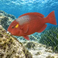

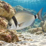
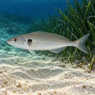
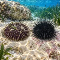
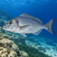


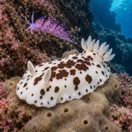
Marked ones can hurt you. What they do and what to do about it is under Getting in and staying safe.
Getting in and staying safe
Drive through Marsaxlokk and follow the road out toward the lighthouse. The last stretch is rough and the parking is roadside, informal and completely unshaded. From the car it is around 150 metres of walking over broken rock to the water, which with full kit is the hardest part of the day. There are no facilities at the point, so eat and use the toilets in Marsaxlokk where the waterfront is lined with cafes. Entry and exit are over rock, so time your step in with the swell. Hunters and trappers use the headland in season and would rather be left alone.
- Very exposed, swell builds quickly from the east and south
- Busy boat traffic from Marsaxlokk and the Freeport, a surface marker is essential
- Long walk over uneven rock carrying full kit
- Rock entry and exit, slippery and awkward in any surge
- Discarded fishing line and old netting, carry a cutting tool
- Depth on the south side, easy to overrun a no-stop limit
- No shade, no water and no phone signal worth relying on
Marine life to respect
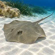
Common stingray · Boll Can hurt you
Whips a barbed tail if stepped on or cornered. Stay off the sand and give it room.

Mediterranean moray · Morina Can hurt you
Bites hard if a hand goes into its hole. Keep hands out of cracks and never feed one.

Red scorpionfish · Ċippullazza Can hurt you
Venomous spines, and it sits still on the rock. Look before you kneel or hold on; hot water if stung.
A bit of history
The peninsula has been watched and fortified for a long time. Delimara Lighthouse has stood on the point since the mid nineteenth century and Fort Delimara was built by the British later in the same century to cover the approaches to Marsaxlokk. Underwater, the stepped ledges and crevices are simply the drowned continuation of the same limestone bedding you scramble over on the walk in.
Divers say
Sign in to rate this site and leave a note for the next diver.
- No reviews yet. First one gets bragging rights.
Further reading: Malta Dive Sites, Delimara · Calypso Sub-Aqua Club, Delimara Point · Dive Systems Malta, South Reef Delimara Point