Massive boulders and swim-throughs on the wild corner of coast beside Ahrax Point, with amberjack cruising overhead and eagle rays turning up often enough to be worth watching for.
 Reef
Sea conditions
Stay dry right now
Sea is up (3.2 m NW) · Fresh WNW wind (58 km/h) · Gusts to 89 km/h
Done for today. Tomorrow: not looking good. Best it gets is 22 at 17:00: Sea is up (1.3 m NW)
Forecast for the site, updated 19:45 · Models disagree
Measured at Ċirkewwa (5.5 km away, 20:29): 63 km/h from WNW, gusts 71. The next hours lean on it.
- Waves
- 3.2 m
- from NW, biggest 4.0
- Wind
- 58 km/h
- WNW, gusts 89
- Swell
- 0.5 m
- 10 s period
- Sea temp
- 22 °C
- air 18 °C
Hour by hour
Next 7 days
 0 3.2 m
48 W
 0 3.0 m
45 WNW
55 0.9 m16 W
87 0.4 m13 ESE
81 0.5 m12 E
 76 0.5 m
18 NNW
83 0.5 m15 SW
Sunrise 06:25, sunset 17:06
Waves: Copernicus Med-Waves 4 km + MFWAM 8 km + EWAM 5 km + ECMWF WAM 9 km. Wind: ICON-2I 2 km + ECMWF IFS 9 km + ICON-EU 7 km + UKMO 10 km + ARPEGE 11 km. Read a few km out on the side the site is open to, then blended.
Exposed to wind and swell from: N (0°), NW (315°), NE (45°). Faces the open north. A northerly or north-westerly puts swell straight into the boulder field and makes the shore entry unsafe long before it makes the diving unpleasant. Best in a southerly or south-westerly, which is also when the water tends to be at its clearest here. Best season: May to October, with September the sweet spot for warm water, good visibility and slightly less boat traffic.
The dive
Rdum l-Ahmar is the red cliff section near Malta's northern tip, and like much of this coast it is built from house-sized blocks that have dropped off the ridge and landed in a heap. Between and under them are gaps, tunnels and arches at every scale, from ones you look through to ones you swim through with room to spare. The maximum depth is a friendly 36 m, so you can enjoy the architecture without watching a computer count down.
As you work outwards the boulders shrink to rubble and then to open sand. That transition zone is the productive bit. Smaller grouper hold station in the deeper block piles, and the open water above the sand is where amberjack come through in packs. Eagle rays are a recurring report here, which is not something you can say about many Maltese sites.
The catch is traffic. This corner of the island is prime summer boating water, with day boats, jet skis and charters running between Ahrax, Comino and Mellieħa Bay all day long. The diving is lovely. The surface is not, and that has to shape how you plan the dive.
- Swim-throughs between boulders the size of small buildings
- A real chance of eagle rays over the sand
- Amberjack schooling in the blue above the rubble line
- Max depth of 36 m keeps it within recreational limits
- Wild, empty corner of coast with a view of Comino
Typical plan
Head out over the boulders to around 30 m where the blocks meet the rubble, spend the first half of the dive working that line and looking up for amberjack, then turn and come back through the swim-throughs at 20 to 12 m. Finish shallow in the big blocks. Forty five to fifty five minutes on a single cylinder, air is fine, nitrox 32 gives you more bottom time at 30 m. A DSMB is essential here rather than optional because of the boat traffic: deploy it before you start your ascent, not at 5 m.
What the bottom looks like
- 1First boulder cluster in the shallows6 m deep · under the boat
- 2Swim-through between two large blocks17 m deep · 30 m from the boat
- 3Longer passage under leaning slabs23 m deep · 55 m from the boat
- 4Deep block pile with resident grouper29 m deep · 90 m from the boat
- 5Rubble giving way to open sand34 m deep · 145 m from the boat


Enormous fallen limestone boulders in the shallows, breaking down into rubble and then clean sand by the middle thirties.
Who you might meet
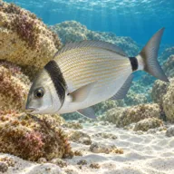
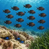
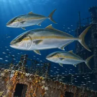
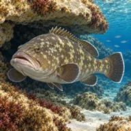
Sometimes
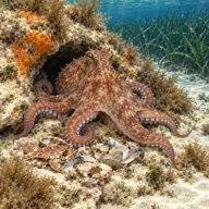
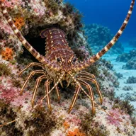
Lucky day
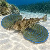
Marked ones can hurt you. What they do and what to do about it is under Getting in and staying safe.
Getting in and staying safe
Officially shore accessible but only just: you need a four wheel drive to get down the dirt track towards Ahrax, then a 90 m walk over sharp, fissured coralline rock to the water. It punishes soft boots and bare hands. Most divers take a boat from Cirkewwa or Mellieħa instead, which also solves the exit problem. Nothing on site: no toilets, no shade, no water, so bring everything and take it away again.
- Heavy boat and jet ski traffic through the summer
- Sharp, needle-like rock on the walk in and out
- No easy exit point if the sea gets up while you are down
- Swim-throughs and overhangs that need a light and care with kit
- Exposed northern aspect with swell wrapping around Ahrax Point
- Remote location with a slow route for emergency help
Marine life to respect
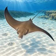
Common eagle ray · Ħamiema Can hurt you
Barbed tail if grabbed or pinned. Watch it pass; it wants nothing to do with you.
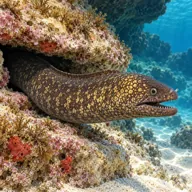
Mediterranean moray · Morina Can hurt you
Bites hard if a hand goes into its hole. Keep hands out of cracks and never feed one.
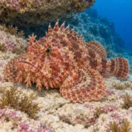
Red scorpionfish · Ċippullazza Can hurt you
Venomous spines, and it sits still on the rock. Look before you kneel or hold on; hot water if stung.
Divers say
Sign in to rate this site and leave a note for the next diver.
- No reviews yet. First one gets bragging rights.
Further reading: Calypso Sub-Aqua Club: Rdum l-Ahmar · Malta Dive Sites northern coast index