A rocky headland on Gozo's south coast that hides one of the island's most theatrical shore dives: a free standing tower of rock whose top sits just under the surface while its seaward flank falls away past 90 metres.
Sea conditions
Marginal right now
Some chop (3.6 m WNW) · Gusts to 59 km/h
Done for today. Tomorrow: diveable from 07:00. Some chop (2.5 m WNW) until then.
Forecast for the site, updated 19:45 · Models disagree
Measured at Mġarr, Gozo (2.7 km away, 19:45): 31 km/h from WNW, gusts 37. The next hours lean on it.
- Waves
- 3.6 m
- from WNW, biggest 5.5
- Wind
- 35 km/h
- WNW, gusts 59
- Swell
- 0.4 m
- 7 s period
- Sea temp
- 22 °C
- air 19 °C
Hour by hour
Next 7 days
 37 3.6 m
45 W
 46 3.5 m
43 WNW
100 0.9 m14 W
 95 0.3 m
13 ESE
 84 0.3 m
12 E
99 0.3 m18 NNW
99 0.3 m16 SSW
Sunrise 06:26, sunset 17:06
Waves: Copernicus Med-Waves 4 km + MFWAM 8 km + EWAM 5 km + ECMWF WAM 9 km. Wind: ICON-2I 2 km + ECMWF IFS 9 km + ICON-EU 7 km + UKMO 10 km + ARPEGE 11 km. Read a few km out on the side the site is open to, then blended.
Exposed to wind and swell from: E (90°), SE (135°), S (180°). Sheltered from the prevailing north westerly, which is why it is a standing plan B when Reqqa and Dwejra are blown out. Southerly and easterly wind puts swell straight onto the entry rocks and makes the exit genuinely awkward. Best season: May to October for the warmest water and 25 to 40 m visibility, though it dives well year round whenever the wind has any north in it..
Dives at Ras il-Hobz
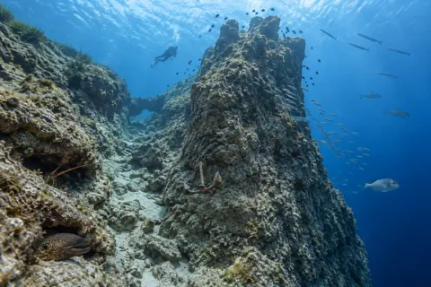 Digital Render

Middle Finger
Ras il-Hobz, Gozo
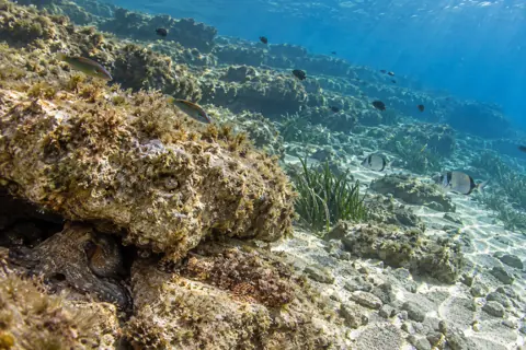 Digital Render

East Reef
Ras il-Hobz, Gozo
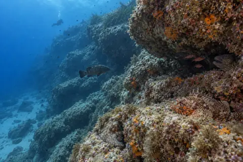 Digital Render
West Reef
Ras il-Hobz, Gozo
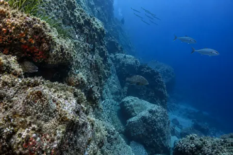 Digital Render
Fessej Rock
Ras il-Hobz, Gozo
The dive
Ras il-Hobz is the sort of place that looks entirely unpromising from the car. You bump down a lane through farmers' fields below Ghajnsielem, park on bare rock, and stare across the channel at mainland Malta wondering what the fuss is about. Then you get in, swim out, and a limestone skyscraper materialises out of the blue.
The headland gives you three quite different dives from the same patch of shore. Straight out and slightly seaward is the pinnacle itself, the Middle Finger, separated from land by a channel that bottoms out near 35 metres. Turn east and you get a gentle, sunny reef that never really troubles the depth gauge, perfect for a second dive or a training session. Turn west and the ground tips over into a proper slope that keeps going well past recreational limits, which is exactly why technical instructors like the place so much.
Because the shore shelters you from the prevailing north westerly, Ras il-Hobz is often diveable on days when the north of Gozo is a washing machine. That makes it one of the standard fallback sites for Gozo centres, and on a summer morning you may share the rock with three or four groups kitting up.
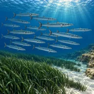
Marine life here benefits from the vertical structure. Baitfish stack up around the tower, and where baitfish stack up, bigger things come to look. Amberjack, dentex and barracuda all patrol the open water side, while the cracks and overhangs keep the moray, octopus and slipper lobster crowd happy.
- A limestone tower rising from the dark to within 10 m of the surface
- Swim through arch and a chimney that pops you out on the other side of the rock
- Shore access to genuinely deep water, a rarity anywhere
- Reliable when the north coast is closed by the majjistral
Typical plan
Kit up on the rock, swim out on the surface for five to ten minutes to save gas, then drop onto the shoulder of the headland and follow it down to about 25 to 30 m. Cross the channel, circle a third of the pinnacle, then come up its flank to the 10 m summit and hang there while the fish traffic goes past. Work back over the shallow shelf at 5 to 6 m, finishing the dive with a long, lazy safety stop. Around 45 minutes on a single 12 litre, and nitrox 32 is money well spent if you intend to spend real time at 30 m.
What the bottom looks like
- 1Shallow shelf used for safety stops5 m deep · 40 m out
- 2Archway running from about 6 m down to 15 m12 m deep · 120 m out
- 3Sloping chimney that exits at around 7 m18 m deep · 150 m out
- 4Floor of the channel between shore and pinnacle35 m deep · 205 m out
- 5Five pointed summit of the Middle Finger9 m deep · 235 m out
- 6Three pronged admiralty anchor jammed in the wall63 m deep · 300 m out
- 7Seaward face heading past technical limits95 m deep · 340 m out


Hard Lower Coralline Limestone reef and boulder with patches of coarse sand and rubble in the channel floor.
Who you might meet
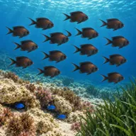
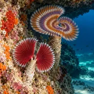
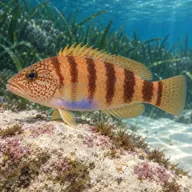
Often

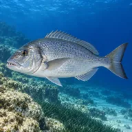
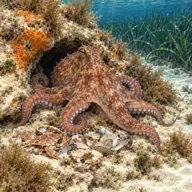
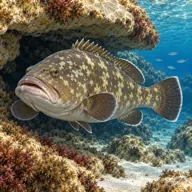
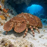
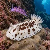
Marked ones can hurt you. What they do and what to do about it is under Getting in and staying safe.
Getting in and staying safe
Drive out of Ghajnsielem on the Ras il-Hobz lane and follow it through the fields until the tarmac gives out on the headland. Parking is informal rock and gravel with room for several dive vans, and it fills up on summer mornings. There is no cafe, no toilet and no shade worth the name, so bring water. Two entry points exist, one on each side of the headland, and most centres use the flat rock beside the outfall pipe from the water treatment plant. Entry is a step or slide into shallow water rather than a leap, and exit is at the same spot, so note your landmarks before you swim off. Hard soled boots make the walk over the rock far more pleasant.
- Depth creep: the seaward side of the pinnacle drops past 90 m with nothing to stop you
- A ten minute surface or shallow swim each way, so plan gas for the return leg
- Sharp, uneven limestone on the walk in and out
- Boat traffic in the Gozo channel, carry an SMB
- No shade and no facilities, heat stress on summer afternoons
- Exit spot is easy to lose track of once you are back on the surface
Marine life to respect
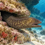
Mediterranean moray · Morina Can hurt you
Bites hard if a hand goes into its hole. Keep hands out of cracks and never feed one.
A bit of history
The promontory sits at the eastern shoulder of the Mgarr ix-Xini inlet, a narrow creek the Knights of St John used as a galley anchorage. In 1551 a raiding Ottoman force used the same inlet to embark captured Gozitans, and just over a century later, in 1661, the Order built the large Mgarr ix-Xini watchtower on the promontory at the mouth of the creek to keep an eye on exactly that sort of visitor. Geologically the whole headland is Lower Coralline Limestone, the hard, grey, bottom of the stack rock that gives Gozo its best walls and pinnacles.
Divers say
Sign in to rate this site and leave a note for the next diver.
- No reviews yet. First one gets bragging rights.
Further reading: Atlantis Gozo Diving site guide · New Dimension Scuba dive site notes · Divers Guide site data and logbook entries · Ritual Dive site description · Wikipedia, Mgarr ix-Xini Tower