Gozo
Newwiela Point
The southernmost tip of Gozo, dived from a boat under towering cliffs. A shallow plateau for the shallow part of the dive, then a wall and boulder field that keeps falling past sixty metres.
Sea conditions
Excellent right now
Flat, sheltered and calm
Forecast for the site, updated 01:45 AM
- Waves
- 0.3 m
- from SE
- Wind
- n/a
- Swell
- 0.2 m
- 5 s period
- Sea temp
- 28 °C
Next 7 days
Exposed to wind and swell from: S (180°), SE (135°), SW (225°), W (270°), E (90°). An exposed cape sticking into open sea, so it takes weather from almost every direction except the north, where the island itself protects it. Boats only run it on settled days, and a building southerly is the usual reason a trip gets cancelled. Watch for current around the tip even when the surface looks calm. Best season: May to October. Late summer and early autumn give the warmest water, the clearest visibility and the most reliable run of calm days..
The dive
Newwiela Point is where Gozo runs out of island. The cliffs above are high and empty, the boat ride there feels like an expedition, and under the surface the site is built like a stage set: a six metre plateau on top, a steep drop-off around its edge, and a wall dressed in enormous fallen boulders running down past sixty metres into sandy slopes that go deeper still.
The usual plan uses that architecture. Divers drop onto the plateau, follow it to the edge, then run the wall down to whatever their training and gas allow, watching the rock change character as the light drops. Small caverns and archways sit near the top, close enough to the plateau to be part of a normal recreational dive. Lower down, the boulders are pockmarked with holes and every third one seems to have something living in it: morays, lobsters, octopus, the occasional grouper that has learned nobody comes down here often.
Being on the point, the site also gets the blue water traffic. Amberjack patrol the edge of the drop-off and barracuda hang in the current line. Visibility is usually generous because there is nothing shallow nearby to stir up.
The plateau earns its keep at the end. Six metres of sunlit rock is a very pleasant place to burn off nitrogen, and after a deep wall run you will be glad it is there.
- Wall and boulder field dropping past sixty metres
- Six metre plateau that makes a luxurious stop or deco platform
- Archways and small caverns right where the shallow dive happens
- Amberjack and barracuda off the point
- Gozo's southernmost cape, big cliffs and a proper sense of remoteness
Typical plan
Drop onto the plateau, swim to the edge and go over the lip with the wall on your shoulder. Work down to a planned maximum, thirty to forty metres for an advanced recreational dive, deeper only with technical training and staged gas. Turn on a third of your supply or when no-stop time runs short, then climb the wall slowly, pick up the archway and caverns on the way up, and spend the last fifteen minutes on the plateau at six metres. Nitrox 28 to 32 suits the recreational version well; deploy a delayed SMB before you leave the wall so the boat can track you.
What the bottom looks like
- 1Shallow plateau, deco and safety stop ground6 m deep · 30 m out
- 2Small caverns near the plateau edge9 m deep · 60 m out
- 3Archway close to the drop-off lip12 m deep · 75 m out
- 4Lip of the main drop-off22 m deep · 95 m out
- 5Wall with holes and crevices40 m deep · 140 m out
- 6Huge boulders sheltering moray, lobster and octopus55 m deep · 180 m out
- 7Sandy slope running deeper64 m deep · 220 m out
Flat coralline limestone on the plateau, then vertical and stepped wall with colossal fallen boulders, giving way to sand slopes below sixty metres.
Who you might meet

Mediterranean moray
Almost always · Morina

Common octopus
Almost always · Qarnit
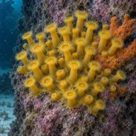
Yellow cluster anemone
Almost always
Golden zoanthids
Almost always
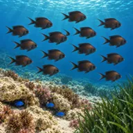
Damselfish
Almost always · Kaħlija
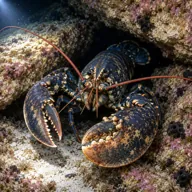
European lobster
Often · Awwista
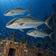
Greater amberjack
Often · Aċċola · Summer
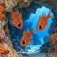
Cardinalfish
Often · Sultan iċ-ċawl

Red scorpionfish
Often · Ċippullazza ħamra

Dusky grouper
Sometimes · Ċerna
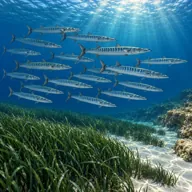
Barracuda
Sometimes · Lizz · Late summer
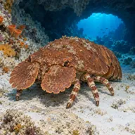
Slipper lobster
Sometimes · Ċikala
Getting in and staying safe
Boat only. Trips run from Mgarr harbour or from Xlendi depending on the operator, and the site is normally combined with other south coast dives on the same outing. There is no shore access of any kind: the cliffs above are sheer and there is no path down. Bring everything you need on the boat, including spare gas and a delayed SMB, because there is nowhere to go if something is missing.
- Depth: the wall runs past 60 m and it is easy to keep going
- Narcosis and rapid gas use on the deeper sections
- Current, sometimes strong, where it wraps around the point
- No shore exit anywhere: you must return to the boat
- Surge on the plateau in any swell
- Small caverns and archways are an overhead, however brief
- Remote location, long ride back to help
A bit of history
Newwiela Point is the southernmost cape of Gozo and, like the rest of the island's south coast, it is a face of Upper Coralline Limestone sitting on softer clays. The wall divers swim is the same rock as the cliffs overhead, and the boulder fields at its foot are the debris of collapses over geological time. No wrecks or recorded losses are associated with the point itself.
Divers say
Sign in to rate this site and leave a note for the next diver.
- No reviews yet. First one gets bragging rights.
Further reading: Wikipedia, Newwiela Point · Atlantis Gozo dive site page · MaltaDives site page · Divers Guide site information · Calypso Sub-Aqua Club site notes