Malta
Ġebel ġol-Baħar
A cluster of big boulders on an offshore plateau about 2 km off St Julian's, claimed in 1999 as a sunken megalithic temple and dismissed by archaeologists ever since. Boat only, top of the rocks at 19 m.
Sea conditions
Good right now
Some chop (0.4 m ESE)
Forecast for the site, updated 01:47 AM
- Waves
- 0.4 m
- from ESE
- Wind
- n/a
- Swell
- 0.4 m
- 5 s period
- Sea temp
- 29 °C
Next 7 days
Exposed to wind and swell from: N (0°), NE (45°), E (90°), SE (135°), S (180°), SW (225°), W (270°), NW (315°). Offshore and unsheltered, so every sector is open and the call is made on sea state. Needs a genuinely calm day for the boat work and for finding the mark. Visibility offshore is usually good, commonly 20 to 30 m. Best season: June to October, when settled seas make the offshore run worthwhile..
The dive
The name means stones in the sea, and stones in the sea is exactly what you get. On a broad plateau roughly 900 by 500 metres, a couple of kilometres off St Julian's, sits a group of very large blocks, weed-covered and arranged in a way that a German investor named Hubert Zeitlmair was convinced in 1999 could only be human work. He described three stone circles with chambers nine to eleven metres across and walls standing six to ten metres high, plus rutted tracks across the seabed resembling Malta's famous cart ruts.
The archaeological community has not come along for the ride. The site was never properly surveyed, the proposed dates of ten to twelve thousand years BC sit badly against the accepted arrival of people on Malta around 5900 BC, and divers who have been down report the boulders look like modern rock illegally dumped rather than anything quarried and dressed. That is the honest summary: a contested site with a colourful origin story and no supporting evidence.
As a dive, judge it on its own terms. The highest point of the rocks is around 19 m, it is a boat trip into open water off a busy coast, and what you actually see is large boulder relief on an otherwise flattish plateau, which in the Mediterranean means fish. Go for the geology, the fish and the story, not for the archaeology.
- Malta's most argued-about underwater site
- Big boulder relief at 19 to 22 m attracting open-water fish
- Rarely dived, so almost nobody you meet will have been
- A good excuse to read up on the real temple period afterwards
Typical plan
Drop on the skipper's mark, land on the boulders at around 19 m and work out and back in a square or a loose circuit, staying above 25 m so you keep a generous no-stop time. Thirty-five to forty-five minutes on air or EAN32 is realistic. Carry a DSMB and a torch for looking into the gaps between blocks, and go in with modest expectations about what you are looking at.
What the bottom looks like
- 1Top of the main boulder cluster19 m deep · 16 m out
- 2Ring-like arrangement of large blocks21 m deep · 35 m out
- 3Rutted tracks across the plateau22 m deep · 80 m out
- 4Low rock outcrops on the plateau23 m deep · 160 m out
- 5Sand and weed on the outer plateau25 m deep · 280 m out
A broad rock and sand plateau with weed cover, broken by very large blocks whose origin is disputed.
Who you might meet
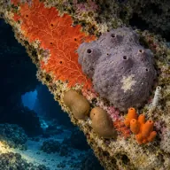
Sponges and encrusting algae
Almost always · Sponża

Two-banded bream
Often · Sargu

Common octopus
Often · Qarnita
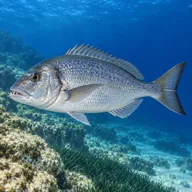
Common dentex
Sometimes · Dentiċi

Greater amberjack
Sometimes · Aċċola · Summer

Dusky grouper
Sometimes · Ċerna

Mediterranean moray
Sometimes · Morina

Barracuda
Sometimes · Lizz · Autumn

Stingray
Lucky day · Boll
Getting in and staying safe
Boat only, roughly 2 km offshore from St Julian's, with no shore option. Very few operators run it and there is no permanent mooring, so finding the boulders takes a skipper who knows the mark and a GPS. Nearest launch points are Sliema, Ta' Xbiex and St Julian's.
- Open water with no shelter and no shore bail-out
- Busy shipping and pleasure boat lanes off the Sliema and St Julian's coast
- Current across the exposed plateau
- Navigation: the boulder group is small relative to the plateau and easy to miss
- Limited operator familiarity, so briefings may be vague
- Depth combined with distance from help
A bit of history
The site was located on 13 July 1999 by divers Shaun and Kurt Arrigo, working to instructions from Hubert Zeitlmair, a retired German real estate investor and follower of the writer Zecharia Sitchin. Zeitlmair announced it as a submerged megalithic temple predating the known temple period by millennia. No formal archaeological study has ever confirmed the claim, and Maltese archaeologists treat it as unproven at best. It remains a fixture of alternative-history writing about Malta and a footnote in the island's real prehistory, which includes genuinely spectacular temples on land at Ħaġar Qim, Mnajdra and Ġgantija.
Divers say
Sign in to rate this site and leave a note for the next diver.
- No reviews yet. First one gets bragging rights.
Further reading: Wikipedia: Ġebel ġol-Baħar · Fake Archaeology Wiki: Ġebel ġol-Baħar · Cart Ruts Malta: underwater cart ruts and temples