Malta
Dragonara Point
A rarely dived rocky point on the St Julian's headland, listed in the older Malta site indexes with about 25 metres under it and almost nothing written about what is actually down there.
Sea conditions
Good right now
Some chop (0.4 m ESE)
Forecast for the site, updated 01:47 AM
- Waves
- 0.4 m
- from ESE
- Wind
- n/a
- Swell
- 0.4 m
- 5 s period
- Sea temp
- 29 °C
Next 7 days
Exposed to wind and swell from: N (0°), NE (45°), E (90°). The headland faces roughly northeast, so it works in the prevailing northwesterly but takes a Grigal from the northeast straight on the nose. Visibility along this stretch is usually moderate rather than spectacular and suffers after heavy weekend boat use. Best treated as a calm, out of season dive. Best season: Late spring and autumn, when the boat traffic thins out but the water is still warm. Midsummer is the worst time here because of the surface activity..
The dive
Dragonara Point is the rocky nose of the St Julian's headland, with the casino and the Westin above it and Merkanti Reef around the corner toward the Hilton. It turns up in one or two older Malta site indexes with an average of 15 metres and a maximum near 25, and then the trail goes cold. No dive centre markets it, no report describes a route, and everything below should be read as an educated guess rather than a briefing.
The geology of this stretch is well understood even if this particular point is not. Expect low limestone ledges and boulder rubble running seaward from the rocks, sand and thin seagrass in the gaps, and a gradual slope rather than a wall. The artificial reef at Merkanti, built from wave-break concrete blocks and now thoroughly colonised, shows what this coast can support, so the natural rock here is unlikely to be barren.
The reason nobody bothers is access and traffic rather than scenery. The shoreline is built up and awkward, with hotel frontage, lidos and private steps along most of it, and the water is busy with pleasure boats, ferries and jet skis right through the summer. If you do dive it, treat it as a boat site or reach it by swimming out from the recognised Merkanti entry, and fly a big surface marker the whole way.
- A blank on the map right in the middle of Malta's busiest resort strip
- Easy link to the well documented Merkanti artificial reef next door
- Gentle ledges and rubble from 9 to 25 metres
- Genuinely unexplored by recreational standards, which is rare on this island
Typical plan
Treat it as an exploratory dive rather than a known route. Enter at the Merkanti bay between the Westin Dragonara and the Hilton, drop to 8 metres and swim out and around the point on a compass bearing, following the rubble line outward until the ledges give way to sand somewhere around 18 to 22 metres. Turn on a fixed time rather than a landmark, since there are none you can rely on, and retrace the bearing back inshore. Forty five minutes on a single cylinder, nitrox 32 if you want more margin, and a delayed surface marker deployed from the moment you leave the shallows because the boat traffic here is relentless.
What the bottom looks like
- 1Boulder rubble off the point9 m deep · 50 m out
- 2Low limestone ledges and overhangs16 m deep · 140 m out
- 3Sand and shell between the rock fingers20 m deep · 220 m out
- 4Thin seagrass on the outer slope23 m deep · 300 m out
Low limestone ledges and boulder rubble giving way to sand and patchy seagrass as the slope runs out.
Who you might meet
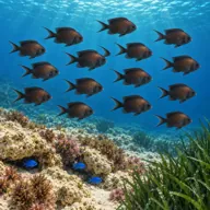
Damselfish
Almost always · Ċawl
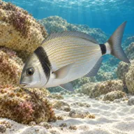
Two-banded bream
Almost always · Sargu
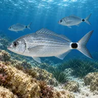
Saddled bream
Almost always · Kaħlija
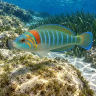
Ornate wrasse
Almost always · Tirda tal-passa
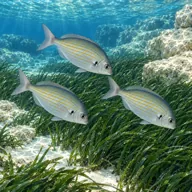
Salema
Almost always · Salpa

Octopus
Sometimes · Qarnit

Moray eel
Sometimes · Morina

Scorpionfish
Sometimes · Ċippullazza
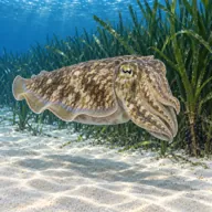
Cuttlefish
Sometimes · Siċċa · Spring
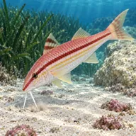
Red mullet
Sometimes · Trilja
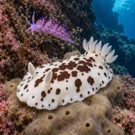
Nudibranchs
Lucky day · Spring
Getting in and staying safe
Hard, and that is most of the reason the site sits unused. The headland is occupied by hotel and casino frontage with very little public shoreline, there is no purpose built dive entry, and parking in St Julian's is difficult all year. In practice the sensible approaches are a boat out of Sliema or St Julian's, or the established Merkanti Reef entry in the small bay between the Westin Dragonara and the Hilton, swimming out and around from there. Cafes, toilets and everything else are abundant, since you are in the middle of a resort strip.
- Heavy summer boat, ferry and jet ski traffic, a surface marker is mandatory
- No established entry or exit, the shoreline is awkward rock and private frontage
- Hotel and lido frontage restricts where you can legitimately get in
- Almost no published information, so navigate conservatively and plan shallow
- Fishing line snagged around the rocks
- Visibility drops noticeably after busy summer weekends
A bit of history
Nothing specific is recorded for the point itself. The wider bay has one footnote: the passenger ferry Star of Malta grounded on Merkanti Reef just around the corner in July 1955, with two lives lost. Above the water the headland carries a nineteenth century palace built for a Maltese banker and later turned into a casino, which is where the name on the chart comes from.
Divers say
Sign in to rate this site and leave a note for the next diver.
- No reviews yet. First one gets bragging rights.
Further reading: Malta Dive Sites, Dragonara Point · Wikipedia, Merkanti Reef · Greatest Dive Sites Malta, Dragonara Point index entry