Gozo
Forna Point
The first headland east of Wied il-Għasri, and one of the least visited walls on Gozo's north coast. Vertical drops on both flanks, a seabed paved with car-sized boulders, and the pleasant suspicion that nothing down there has seen a diver this month.
Sea conditions
Excellent right now
Flat, sheltered and calm
Forecast for the site, updated 01:47 AM
- Waves
- 0.4 m
- from ESE
- Wind
- n/a
- Swell
- 0.3 m
- 5 s period
- Sea temp
- 28 °C
Next 7 days
Exposed to wind and swell from: N (0°), NE (45°), NW (315°), W (270°). A summer site. Anything from north or northwest builds fast on this coast and the skippers will call it off before you have zipped up. Southerly winds flatten it completely, which is when to ask for it. Best season: June to October, with September and October giving the best combination of warm water and long visibility..
The dive
Forna Point is what happens when a limestone ridge runs out of land. Both sides of the headland fall away steeply, and where the wall finally gives up it dumps into a field of boulders so large that swimming between them feels like moving through a collapsed cathedral. Visibility on the north coast is habitually excellent, often twenty-five metres and sometimes far more, which makes the scale of the place obvious in a way that murkier sites never manage.
Because hardly anyone comes here, the fish behave differently. Grouper sit out in the open instead of reversing into holes, dentex cruise past at the edge of vision, and tuna occasionally appear as shapes high in the blue and then are not there any more. It is not a guaranteed big-animal site, but the odds are better than at anywhere on the popular circuit.
Round the point to the east and the cliff steps back into a pair of caverns, the larger of them the cave the boatmen call tal-Margun. Their walls carry the yellow and orange encrusting growth that the north coast does so well, and the light through the entrances is worth carrying a torch just to turn off. Guides often link Forna Point and the caves into one longer dive when the sea is kind.
- Twin drop-offs on either side of a rarely dived headland
- Boulder field at 30 to 40 metres with gullies to thread
- Two coral-lined caverns just east of the point
- Genuinely good odds on grouper, dentex and passing pelagics
- North coast visibility that regularly runs past 25 metres
Typical plan
Drop on the lee flank, drift down the wall to 35 or 40 metres over the boulders, and spend the first fifteen minutes there working the gullies. Come up as you round toward the east and finish the dive in the caverns at 15 to 20 metres, then hold a shallow shelf at 6 metres for the stop before the pick-up. Forty-five minutes on nitrox 32 keeps it comfortably inside no-stop limits; on air, budget for a short deco obligation and carry a delayed SMB.
What the bottom looks like
- 1Vertical drop off the flank of the headland14 m deep · 20 m out
- 2Main wall face29 m deep · 60 m out
- 3Field of car-sized boulders38 m deep · 110 m out
- 4Western of the two caverns east of the point20 m deep · 225 m out
- 5Second cavern, coral-lined entrance16 m deep · 250 m out
- 6Shallow shelf for the safety stop9 m deep · 300 m out
Broken slabs and enormous fallen boulders on bare rock, with thin sand and shell gravel collecting in the gullies between them.
Who you might meet
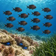
Mediterranean damselfish
Almost always · Ċawla sewda
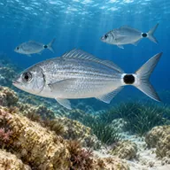
Saddled bream
Almost always · Kaħlija
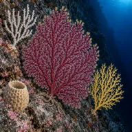
Encrusting sponges and gorgonian growth
Almost always

Dusky grouper
Often · Ċerna
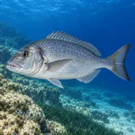
Dentex
Often · Dentiċi

Common octopus
Often · Qarnit
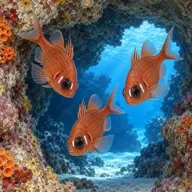
Cardinalfish
Often · Re di trilji · In the caverns
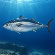
Atlantic bluefin tuna
Sometimes · Tonn · Summer
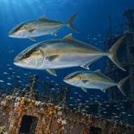
Greater amberjack
Sometimes · Aċċola · Late summer

Mediterranean moray
Sometimes · Morina
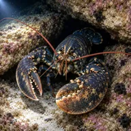
European lobster
Lucky day · Awwista
Getting in and staying safe
Boat only, and usually a half-hour run depending on where you leave from. Charters go from Mġarr harbour, from Xlendi and from Marsalforn, and the Marsalforn boats have the shortest hop. There is no shore, no ladder and no shelter, so it is a live-boat or anchored drop with a pick-up at the end; carry an SMB and deploy it early. Parking and facilities are whatever the charter base offers. Nothing at the site itself, so eat, drink and use the toilet before you leave the quay.
- Boat-only site with no bail-out shore, so a missed pick-up is a real problem
- Variable current around the point, often strongest right on the tip
- Depth creep: the boulder field keeps going below 40 m and the clear water hides it
- Surge inside the caverns when there is any north in the sea
- Sea state can change quickly on this coast, cutting the dive short
- Fishing line and lost tackle snagged on the shallower rocks
A bit of history
No wrecks and no legends here, just rock. The headland is Lower Coralline limestone, the hard grey stuff that forms the base of the Maltese sequence and the reason this stretch of coast stands in cliffs rather than beaches. The Maltese word forna comes from the oven, a common enough coastal name for a hollow in the rock that looks like a bread oven mouth. The whole northern shoreline from Reqqa to Forna is a string of these headlands and valleys, each one a separate dive and each one exposed to the same northerly weather.
Divers say
Sign in to rate this site and leave a note for the next diver.
- No reviews yet. First one gets bragging rights.
Further reading: Divers Guide: Forna Point · Malta Sub Aqua Club: Forna Point · Atlantis Gozo dive site guide · Malta Dives: Forna Point