A low limestone islet sitting about 65 m off the Qala coast, on the Gozo side of the North Comino Channel. It is snorkelled and freedived constantly and dived with a tank almost never, so treat any dive here as your own exploration.
 Other
Divers rarely, if ever, come here.
We found no record of anyone diving this site. It is charted so the picture of what lies under the water is complete, not because it is a place to go: there is no set route, no local briefing to lean on, and nothing on this page has been proven in the water.
Sea conditions
Reading the sea…
Exposed to wind and swell from: E (90°), SE (135°), S (180°). Gozo sits between the rock and the prevailing northwesterly, which is why this corner of Qala stays swimmable most of the summer. Pilotage notes for the anchorage call it open to easterly and southerly winds, and that is the honest read: anything from E through SE to S comes straight in. Comino, a bit over two kilometres south, takes some of the sting out of a true southerly, but swell still wraps around both ends of the channel, and a southwesterly can push a long fetch up the gap. Best season: June to October, when the channel is flat, the visibility is at its best and boats are easy to arrange. Avoid it in any easterly..
The dive
Ħalfa Rock is one of those places everyone in Gozo can point to and almost nobody has written a dive plan for. The dive indexes carry it as a site, then leave the depth, rating and description blank, and the local diving press has used it as an example of how many Gozitan sites never make it onto an official list. What does exist in quantity is snorkelling and freediving traffic: the broken ground between the islet and Ħondoq ir-Rummien has a good reputation among people who hold their breath for a living, and boat and jet-ski tours out of Mġarr and Marfa park up here most summer afternoons.
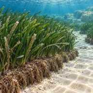
The terrain is easy to picture even without a survey, because its neighbours are documented. Ħondoq Bay next door bottoms out around 12 to 15 m on sand and Neptune grass, and Ras il-Qala just up the coast is a reef dive averaging 10 m with 15 m at the bottom. Ħalfa sits between them with the same recipe: shallow rock and fallen blocks around the base of the islet, cracks and small caves for morays and octopus, then a run of submerged rocks trailing out into the channel before the ground gives up and turns into clay, fine sand and seagrass. The North Comino Channel itself does not get much past the mid twenties, so nothing here is deep.
What makes the rock more than a shallow pootle is the setting. You are on the edge of a busy shipping and pleasure-boat corridor with Comino in full view a mile and a bit south, the water is usually glassy, and the current that runs west to east through the gap can turn a lazy swim into work. Go by boat, keep the profile modest, and accept that every number below is reasoned from the neighbourhood rather than lifted from a published guide. The islet itself is a protected reserve with endemic lizards, snails and plants on top, so the plan never includes climbing out onto it.
- A landmark islet that gets snorkelled daily and dived almost never
- Shallow reef, boulders and small caves in famously clear channel water
- A trail of submerged rocks running out into the North Comino Channel
- Protected reserve above the waterline, with endemic lizards, snails and plants
- The Dragut oath legend and the esparto grass that probably really named it
Typical plan
There is no standard plan here, which is rather the point. Come in by boat with the skipper staying with it, drop on the north or east side of the islet, work the boulders and crevices around the base in 5 to 12 m, then follow the submerged rocks south into the channel to a sensible turn at 18 to 20 m before drifting back with the current on your shoulder. One tank, nitrox pointless at these depths, a generous reserve because the exit is the boat and nothing else, and a reel or a marker if you plan to range out over the scattered rocks. A calm morning with a snorkel is arguably the better use of the same water.
What the bottom looks like
- 1Sandy gap between the Gozo shore and the islet7 m deep · 40 m out · under the boat
- 2Fallen limestone blocks around the base of the rock5 m deep · 70 m out · 30 m from the boat
- 3Cracks, overhangs and small caves on the seaward face12 m deep · 125 m out · 85 m from the boat
- 4Ġebel tal-Ħalfa submerged rocks, scattered within 400 m of the islet18 m deep · 240 m out · 200 m from the boat
- 5Neptune grass meadow on the channel floor22 m deep · 330 m out · 290 m from the boat
- 6Clay and fine sand of the North Comino Channel25 m deep · 430 m out · 390 m from the boat


Broken limestone and boulder close to the islet, giving way to fine sand, a thick clay layer and patchy Neptune grass out in the channel.
Who you might meet
Almost always
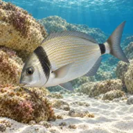
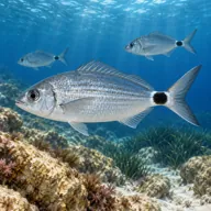
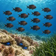
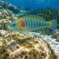
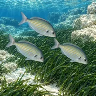
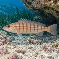
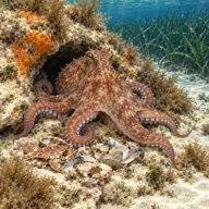
Sometimes
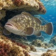
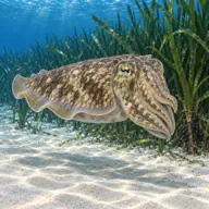
Marked ones can hurt you. What they do and what to do about it is under Getting in and staying safe.
Getting in and staying safe
Only for serious professionals who know exactly what they are doing. With no record of anyone diving here there is no one to ask and no set route, so treat every line below as the start of your own planning, not a briefing. Plan it as an expedition, not a dive.
Realistically this is a boat site. Charters and jet-ski safaris out of Mġarr, Ħondoq and Marfa already stop here, and a boat also solves the exit problem, which the shore does not. On foot you are looking at roughly half an hour east from Ħondoq ir-Rummien along the coast towards Żrieżaq Bay, with scrambling and bouldering on the way, which is a walk to enjoy empty handed and to regret under a twin set. There are no ladders, no steps and no shelter anywhere near the rock, and landing on the islet is off the table because of its protected status. Ħondoq ir-Rummien, about 850 m west, is the support base: car park, kiosk, toilets and a slipway and jetty you can enter from, and it is only a couple of minutes away by boat.
- Effectively unsurveyed for scuba, so this is an exploratory dive and should be planned as one
- Heavy small-boat, charter and jet-ski traffic through the summer, with swimmers in the water too
- Current through the North Comino Channel, usually running west to east and occasionally strong
- Submerged rocks scattered up to 400 m around the islet, easy to lose track of your position over
- Surge and shallow rock close in, with no sheltered exit if it picks up
- Protected reserve: no landing on the islet and nothing taken from the water
- No facilities, no ladder and no easy shore exit, so a boat pick-up is the safety plan
Marine life to respect

Mauve stinger · Brama Can hurt you
Stings on contact, loose tentacles too. Cover skin; rinse with seawater only, then heat. No fresh water, no vinegar.
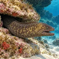
Mediterranean moray · Morina Can hurt you
Bites hard if a hand goes into its hole. Keep hands out of cracks and never feed one.
A bit of history
Ħalfa is the Maltese word for esparto grass, which still grows on the crown of the islet alongside a pyramidal orchid, Maltese leek and stunted lentisk, and that is very probably where the name comes from. The same word also means an oath, which is why English charts and guidebooks sometimes call it Oath Isle, and Gozitan tradition duly supplies a story to match: the Ottoman corsair Dragut is said to have stood on this rock and sworn vengeance after his brother was killed in the raid of 1544, a vow he made good in 1551 when Gozo was sacked and most of its population carried off into slavery. Whether anyone actually swore anything here is a matter for the storytellers rather than the record. Geologically the rock is limestone continuous with the high ground of Qala and with Comino across the water. It is listed on the national natural heritage inventory, protected as a special area of conservation and graded a Level 1 Site of Scientific Importance for ecology, and it is home to an isolated population of the endemic Maltese wall lizard and its own door snails. Long-distance swimmers know it as a turning marker in the annual Malta to Gozo and back race.
Divers say
Sign in to rate this site and leave a note for the next diver.
- No reviews yet. First one gets bragging rights.
Further reading: Wikipedia: Ħalfa Rock, geology, etymology, protection and the submerged rock chain · Sea-Seek: Gebla tal-Halfa anchorage, exposure to easterly and southerly winds · Outdoor Explorers Malta: Ħalfa Rock and Żrieżaq Bay, access, currents and marine life · Malta Dives: Ras il-Qala, the neighbouring reef dive and its depths · Blue Waters Dive Cove: Ħondoq Bay terrain, seagrass and marine life · DivingInfo Malta: Ħalfa Rock among the Gozo sites left off the official list